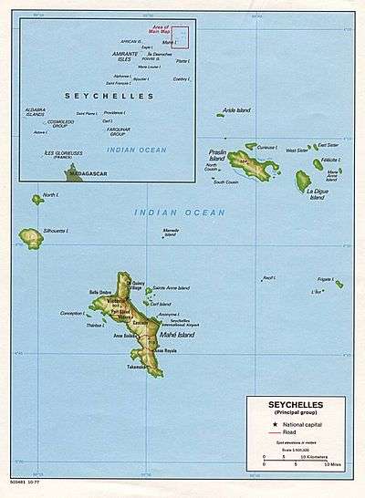
Perseverance Island, Seychelles
 Perseverance Island | |
| Geography | |
|---|---|
| Location | Seychelles, Indian Ocean |
| Coordinates | 4°36′18″S 55°27′54″E / 4.605°S 55.465°ECoordinates: 4°36′18″S 55°27′54″E / 4.605°S 55.465°E |
| Archipelago | Inner Islands, Seychelles |
| Adjacent bodies of water | Indian Ocean |
| Area | 0.99 km2 (0.38 sq mi) |
| Length | 1.4 km (0.87 mi) |
| Width | 1.0 km (0.62 mi) |
| Coastline | 5.3 km (3.29 mi) |
| Highest elevation | 5 m (16 ft) |
| Administration | |
| Group | Granitic Seychelles |
| Sub-Group | Mahe Islands |
| Sub-Group | Mahe Port Islands |
| Districts | Anse Etoile |
| Demographics | |
| Ethnic groups | Creole, French, East Africans, Indians. |
| Additional information | |
| Time zone | |
| ISO code | SC-03 |
Perseverance Island (French: Ile Perseverance) is an artificial island in Seychelles, lying 2 km from the capital Victoria.
History
The island was created artificially during the 2000s. It belongs to the Mahe Port Islands, which are mostly artificial islands created by funds from Dubai when the Dubai dredger was placed in Seychelles.[1] In 2013 work on the island has begun.[2][3] by 2020, the island should house 10,000, more than 15% of the population of Seychelles [4][5][6][7]
Administration
The island belongs to Anse Etoile District.[8]
Tourism
The island's plan is mostly residential.[9] There is a large Army Naval base at the south point.
Image gallery
 Map 1
Map 1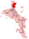 District Map
References
External links
| Wikimedia Commons has media related to Perseverance Island. |
This article is issued from
Wikipedia.
The text is licensed under Creative Commons - Attribution - Sharealike.
Additional terms may apply for the media files.