Perry Township, Pike County, Ohio
| Perry Township, Pike County, Ohio | |
|---|---|
| Township | |
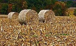 Baled corn in a field in Perry Township | |
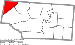 Location of Perry Township in Pike County | |
| Coordinates: 39°9′43″N 83°20′2″W / 39.16194°N 83.33389°WCoordinates: 39°9′43″N 83°20′2″W / 39.16194°N 83.33389°W | |
| Country | United States |
| State | Ohio |
| County | Pike |
| Area | |
| • Total | 23.0 sq mi (59.5 km2) |
| • Land | 23.0 sq mi (59.5 km2) |
| • Water | 0.0 sq mi (0.0 km2) |
| Elevation[1] | 922 ft (281 m) |
| Population (2000) | |
| • Total | 913 |
| • Density | 39.7/sq mi (15.3/km2) |
| Time zone | UTC-5 (Eastern (EST)) |
| • Summer (DST) | UTC-4 (EDT) |
| FIPS code | 39-62022[2] |
| GNIS feature ID | 1086816[1] |
Perry Township is one of the fourteen townships of Pike County, Ohio, United States. The 2000 census found 913 people in the township.[3]
Geography
Located in the northwestern corner of the county, it borders the following townships:
- Paxton Township, Ross County - north
- Benton Township - east
- Mifflin Township - southeast
- Brushcreek Township, Highland County - west
- Paint Township, Highland County - northwest
No municipalities are located in Perry Township, although the unincorporated community of Cynthiana lies in the northwestern part of the township.
Name and history
It is one of twenty-six Perry Townships statewide.[4]
Government
The township is governed by a three-member board of trustees, who are elected in November of odd-numbered years to a four-year term beginning on the following January 1. Two are elected in the year after the presidential election and one is elected in the year before it. There is also an elected township fiscal officer,[5] who serves a four-year term beginning on April 1 of the year after the election, which is held in November of the year before the presidential election. Vacancies in the fiscal officership or on the board of trustees are filled by the remaining trustees.
References
- 1 2 "US Board on Geographic Names". United States Geological Survey. 2007-10-25. Retrieved 2008-01-31.
- ↑ "American FactFinder". United States Census Bureau. Retrieved 2008-01-31.
- ↑ Pike County, Ohio — Population by Places Estimates Archived 2016-11-25 at the Wayback Machine. Ohio State University, 2007. Accessed 15 May 2007.
- ↑ "Detailed map of Ohio" (PDF). United States Census Bureau. 2000. Retrieved 2007-02-16.
- ↑ §503.24, §505.01, and §507.01 of the Ohio Revised Code. Accessed 4/30/2009.
External links
Municipalities and communities of Pike County, Ohio, United States | ||
|---|---|---|
| Villages | 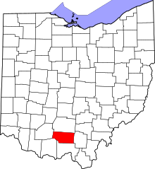 | |
| Townships | ||
| CDPs | ||
| Unincorporated communities | ||