Penny Pot, New Jersey
| Penny Pot, New Jersey | |
|---|---|
| Unincorporated community | |
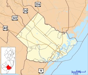 Penny Pot Location in Atlantic County (Inset: Atlantic County in New Jersey)  Penny Pot Penny Pot (New Jersey)  Penny Pot Penny Pot (the US) | |
| Coordinates: 39°34′19″N 74°49′20″W / 39.57194°N 74.82222°WCoordinates: 39°34′19″N 74°49′20″W / 39.57194°N 74.82222°W | |
| Country |
|
| State |
|
| County | Atlantic |
| Borough | Folsom |
| Elevation[1] | 15 m (49 ft) |
| Time zone | UTC-5 (Eastern (EST)) |
| • Summer (DST) | UTC-4 (EDT) |
| GNIS feature ID | 879222[1] |
Penny Pot is an unincorporated community within the borough of Folsom in Atlantic County, New Jersey, United States.[1][2]
The Hospitality Branch flows into the Great Egg Harbor River at Penny Pot. A dam was built at Penny Pot made of timbers salvaged from the hull of a British ship pirated during the Revolutionary War.[3]
References
- 1 2 3 U.S. Geological Survey Geographic Names Information System: Penny Pot
- ↑ Locality Search, State of New Jersey. Accessed June 9, 2016.
- ↑ John, McPhee (2011). The Pine Barrens. Macmillan.

This article is issued from
Wikipedia.
The text is licensed under Creative Commons - Attribution - Sharealike.
Additional terms may apply for the media files.