Pembina River Provincial Park
| Pembina River Provincial Park | |
|---|---|
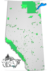
 Location of Pembina River Provincial Park in Alberta | |
| Location | Yellowhead County, Alberta, Canada |
| Nearest city | Entwistle, Evansburg |
| Coordinates | 53°36′28″N 114°59′50″W / 53.60778°N 114.99722°WCoordinates: 53°36′28″N 114°59′50″W / 53.60778°N 114.99722°W |
| Area | 191 ha (470 acres) |
| Established | September 21, 1953 |
| Governing body | Alberta Tourism, Parks and Recreation |
Pembina River Provincial Park is a provincial park in central Alberta, Canada.
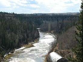
Pembina River gorge
It is located between the towns of Entwistle and Evansburg, a short distance from the Yellowhead Highway. The short 16A highway spur crosses the southern edge of the park, which is developed along the gorges of the Pembina River. The gorges cut in sandstone reach 62m in height, and were formed during the glaciation.
Activities
Birding and camping are the most common activities in the park.[1] Water related sports like fishing, canoeing and tubing are also popular.
See also
References
- ↑ Alberta Tourism, Parks, Recreation & Culture. "Activities in Pembina River Provincial Park". Retrieved 2007-07-22.
External links
- Alberta Tourism, Parks, Recreation & Culture. "Pembina River Provincial Park". Retrieved 2007-07-22.
This article is issued from
Wikipedia.
The text is licensed under Creative Commons - Attribution - Sharealike.
Additional terms may apply for the media files.