Pecixe
 Pecixe Location | |
| Geography | |
|---|---|
| Location | Atlantic Ocean |
| Coordinates | 11°50′00″N 16°05′00″W / 11.8333°N 16.0833°WCoordinates: 11°50′00″N 16°05′00″W / 11.8333°N 16.0833°W[1] |
| Area | 168 km2 (65 sq mi) |
| Length | 20.6 km (12.8 mi) |
| Width | 12.8 km (7.95 mi) |
| Highest elevation | 6 m (20 ft) |
| Administration | |
| Region | Cacheu Region |
| Sector | Caió |
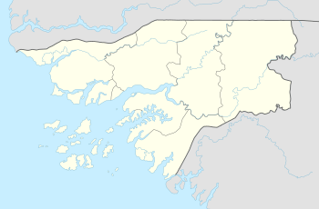
Pecixe is an island in Guinea-Bissau. It is a coastal island belonging to the Cacheu Region and the Caió sector. The area is 168 km², its length is 20.6 km and its width 12.8 km. Cassaca is the chief town. The language of the island or islands is reported to be Mandjak (Portuguese: Manjago, also known as Manjaku), a language of Guinea-Bissau with over 72,000 speakers altogether.[2] Jeta island lies to the west. It is 3 km off the mainland, separated from it by the Canal de Gebá. Around the end of the Ice Age, it formed a part of the mainland.
Its location is 50 km west of the capital city of Bissau and is located west of the mouth of the Mansoa River. Other nearby featured includes Ilha de Mantambua and its channel to the northeast, three promontories are to the south and a few islets. A lighthouse is located west of Injante. Other towns includes BIeu and Injante.
Its natural vegetation like every part of the coastline of Guinea-Bissau consists of mangrove forests and a swampy rainforest. It has a tropical climate and heavy rainfall occurs during the summer months. Logging activity occurred in recent decades, some of the land would be for agricultural use, much of it inside a built up area and some within swamps but many areas remains a forest and being used as a forest farm.
History
Around 1963 Cassaca was liberated from Portuguese rule. The first party congress of the African Party for the Independence of Guinea and Cape Verde (PAIGC) shortly took place in February 1964. Years later, the island continued to be under Portuguese rule until around early 1974 before Guinea-Bissau became independent later in the year.
See also
References
- ↑ Ilha de Pecixe - Mapcarta
- ↑ Diedrich Westermann & Margaret Arminel Bryan, The Languages of West Africa International African Institute 1970.