Paz River
| Río Paz | |
|---|---|
 | |
| Country | Guatemala, El Salvador |
| Physical characteristics | |
| Main source |
Quezalapa Mountains, Guatemala 1,700 m (5,600 ft) 14°22′06″N 90°02′13″W / 14.36833°N 90.03694°W |
| River mouth |
Pacific Ocean 0 m (0 ft) 13°46′16″N 90°10′57″W / 13.77111°N 90.18250°WCoordinates: 13°46′16″N 90°10′57″W / 13.77111°N 90.18250°W |
| Length | 134 km (83 mi) |
| Discharge |
|
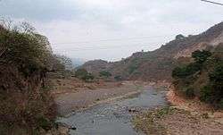
The Río Paz (Spanish pronunciation: [ˈri.o pas]) is a river in southern Guatemala. Its sources are located in the Quezalapa mountains in the north of Jutiapa. From there it flows in a south-westerly direction and marks the border with El Salvador for most of its course before reaching the Pacific Ocean at 13°46′16″N 90°10′57″W / 13.77111°N 90.18250°W.[1]
The Paz River is 134 kilometres (83 mi) long, and its river basin covers a territory of 1,732 square kilometres (669 sq mi) in Guatemala.[2]
It flows through the Ahuachapán Department and into the Laguna el Espino.
References
- ↑ INSIVUMEH. "Mapa de Cuencas y Ríos".
- ↑ INSIVUMEH. "Principales ríos de Guatemala".
This article is issued from
Wikipedia.
The text is licensed under Creative Commons - Attribution - Sharealike.
Additional terms may apply for the media files.