Rozel, Kansas
| Rozel, Kansas | |
|---|---|
| City | |
 Location within Pawnee County and Kansas | |
 KDOT map of Pawnee County (legend) | |
| Coordinates: 38°11′45″N 99°24′9″W / 38.19583°N 99.40250°WCoordinates: 38°11′45″N 99°24′9″W / 38.19583°N 99.40250°W | |
| Country | United States |
| State | Kansas |
| County | Pawnee |
| Area[1] | |
| • Total | 0.17 sq mi (0.44 km2) |
| • Land | 0.17 sq mi (0.44 km2) |
| • Water | 0 sq mi (0 km2) |
| Elevation | 2,073 ft (632 m) |
| Population (2010)[2] | |
| • Total | 156 |
| • Estimate (2016)[3] | 150 |
| • Density | 920/sq mi (350/km2) |
| Time zone | UTC-6 (Central (CST)) |
| • Summer (DST) | UTC-5 (CDT) |
| ZIP code | 67574 |
| Area code(s) | 620 |
| FIPS code | 20-61600 [4] |
| GNIS feature ID | 0475837 [5] |
Rozel is a city in Pawnee County, Kansas, United States. As of the 2010 census, the city population was 156.[6]
History
The first post office in Rozel was established in 1893.[7] The community was named in honor of Roseila, the daughter of a businessman.[8]
Geography
Rozel is located at 38°11′45″N 99°24′09″W / 38.195870°N 99.402444°W (38.195870, -99.402444).[9] According to the United States Census Bureau, the city has a total area of 0.17 square miles (0.44 km2), all land.[1]
Demographics
| Historical population | |||
|---|---|---|---|
| Census | Pop. | %± | |
| 1930 | 220 | — | |
| 1940 | 203 | −7.7% | |
| 1950 | 233 | 14.8% | |
| 1960 | 207 | −11.2% | |
| 1970 | 236 | 14.0% | |
| 1980 | 219 | −7.2% | |
| 1990 | 187 | −14.6% | |
| 2000 | 182 | −2.7% | |
| 2010 | 156 | −14.3% | |
| Est. 2016 | 150 | [3] | −3.8% |
| U.S. Decennial Census | |||
2010 census
As of the census[2] of 2010, there were 156 people, 66 households, and 43 families residing in the city. The population density was 917.6 inhabitants per square mile (354.3/km2). There were 85 housing units at an average density of 500.0 per square mile (193.1/km2). The racial makeup of the city was 100.0% White. Hispanic or Latino of any race were 4.5% of the population.
There were 66 households of which 24.2% had children under the age of 18 living with them, 60.6% were married couples living together, 1.5% had a female householder with no husband present, 3.0% had a male householder with no wife present, and 34.8% were non-families. 31.8% of all households were made up of individuals and 13.7% had someone living alone who was 65 years of age or older. The average household size was 2.36 and the average family size was 3.02.
The median age in the city was 44.5 years. 23.1% of residents were under the age of 18; 6.3% were between the ages of 18 and 24; 21.2% were from 25 to 44; 30.8% were from 45 to 64; and 18.6% were 65 years of age or older. The gender makeup of the city was 51.3% male and 48.7% female.
2000 census
As of the census[4] of 2000, there were 182 people, 72 households, and 48 families residing in the city. The population density was 825.4 people per square mile (319.4/km2). There were 86 housing units at an average density of 390.0 per square mile (150.9/km2). The racial makeup of the city was 96.70% White, 0.55% from other races, and 2.75% from two or more races. Hispanic or Latino of any race were 1.10% of the population.
There were 72 households out of which 33.3% had children under the age of 18 living with them, 58.3% were married couples living together, 6.9% had a female householder with no husband present, and 33.3% were non-families. 31.9% of all households were made up of individuals and 15.3% had someone living alone who was 65 years of age or older. The average household size was 2.53 and the average family size was 3.25.
In the city, the population was spread out with 31.3% under the age of 18, 7.1% from 18 to 24, 24.2% from 25 to 44, 20.9% from 45 to 64, and 16.5% who were 65 years of age or older. The median age was 35 years. For every 100 females, there were 83.8 males. For every 100 females age 18 and over, there were 86.6 males.
The median income for a household in the city was $33,750, and the median income for a family was $45,893. Males had a median income of $25,833 versus $21,875 for females. The per capita income for the city was $14,151. About 6.1% of families and 8.6% of the population were below the poverty line, including 11.3% of those under the age of eighteen and 6.3% of those sixty five or over.
Education
Rozel is a part of USD 496 Pawnee Heights. The Pawnee Heights High School mascot is Tigers.[10]
Rozel High School was closed through school unification. The Rozel Tigers[11] won the Kansas State High School boys class BB basketball championship in 1959 and the boys class B basketball championship in 1960.[12]
Notable people
- Gary Patterson, head football coach at TCU
- Glee Smith, Jr., Kansas state legislator and lawyer
See also
References
- 1 2 "US Gazetteer files 2010". United States Census Bureau. Archived from the original on 2012-01-24. Retrieved 2012-07-06.
- 1 2 "American FactFinder". United States Census Bureau. Retrieved 2012-07-06.
- 1 2 "Population and Housing Unit Estimates". Retrieved June 9, 2017.
- 1 2 "American FactFinder". United States Census Bureau. Archived from the original on 2013-09-11. Retrieved 2008-01-31.
- ↑ "US Board on Geographic Names". United States Geological Survey. 2007-10-25. Retrieved 2008-01-31.
- ↑ "2010 City Population and Housing Occupancy Status". U.S. Census Bureau. Archived from the original on July 21, 2011. Retrieved September 15, 2011.
- ↑ "Kansas Post Offices, 1828-1961". Kansas Historical Society. Archived from the original on October 9, 2013. Retrieved 22 June 2014.
- ↑ "Profile for Rozel, Kansas". ePodunk. Retrieved 22 June 2014.
- ↑ "US Gazetteer files: 2010, 2000, and 1990". United States Census Bureau. 2011-02-12. Retrieved 2011-04-23.
- ↑ "Pawnee Heights - USD 496". USD 496. Retrieved 5 January 2017.
- ↑ "Rozel Pins Windthorst For Title", Great Bend Tribune, 13 February 1959, p.7.
- ↑ "Basketball". KSHSAA. Retrieved 3 January 2017.
External links
| Wikimedia Commons has media related to Rozel, Kansas. |
- City
- Schools
- USD 496, local school district
- Maps
- Rozel City Map, KDOT
Municipalities and communities of Pawnee County, Kansas, United States | ||
|---|---|---|
| Cities | 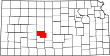 | |
| Unincorporated communities | ||