Pavilion (CDP), New York
| Pavilion, New York | |
|---|---|
| Census-designated place | |
 Pavilion  Pavilion | |
| Coordinates: 42°52′33″N 78°1′21″W / 42.87583°N 78.02250°WCoordinates: 42°52′33″N 78°1′21″W / 42.87583°N 78.02250°W | |
| Country | United States |
| State | New York |
| County | Genesee |
| Area | |
| • Total | 3.31 sq mi (8.58 km2) |
| • Land | 3.31 sq mi (8.58 km2) |
| • Water | 0.0 sq mi (0.0 km2) |
| Elevation | 955 ft (291 m) |
| Population (2010) | |
| • Total | 646 |
| • Density | 200/sq mi (75/km2) |
| Time zone | UTC-5 (Eastern (EST)) |
| • Summer (DST) | UTC-4 (EDT) |
| ZIP code | 14525 |
| Area code(s) | 585 |
| FIPS code | 36-56781 |
| GNIS feature ID | 2628177 |
Pavilion is a hamlet and census-designated place within the town of Pavilion in Genesee County, New York, United States. As of the 2010 census, the population of the CDP was 646,[1] out of a total of 2,495 people in the town as a whole.
Geography
The hamlet is in southeastern Genesee County in the southern part of the town of Pavilion, at the intersection of New York State Routes 19 and 63. NY 19 (Lake Street) leads north 7 miles (11 km) to Le Roy and southwest 12 miles (19 km) to Warsaw, while NY 63 leads northwest 12 miles (19 km) to Batavia, the county seat, and southeast 13 miles (21 km) to Geneseo. The southern edge of the CDP follows the Genesee County/Wyoming County line.
According to the United States Census Bureau, Pavilion CDP has a total area of 3.3 square miles (8.6 km2), all of it land.[1] Oatka Creek, a tributary of the Genesee River, flows northward through the western side of the CDP.
See also
- Pavilion, New York, for the town as a whole
References
- 1 2 "Geographic Identifiers: 2010 Demographic Profile Data (G001): Pavilion CDP, New York". American Factfinder. U.S. Census Bureau. Retrieved December 27, 2016.
Municipalities and communities of Genesee County, New York, United States | ||
|---|---|---|
| City | 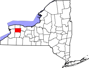 | |
| Towns | ||
| Villages | ||
| CDP | ||
| Hamlets | ||
| Indian reservation | ||
| Footnotes | ‡This populated place also has portions in an adjacent county or counties | |