Paulina, Louisiana
| Paulina, Louisiana | |
|---|---|
| Unincorporated community | |
 Paulina, Louisiana  Paulina, Louisiana | |
| Coordinates: 30°01′35″N 90°42′47″W / 30.02639°N 90.71306°WCoordinates: 30°01′35″N 90°42′47″W / 30.02639°N 90.71306°W | |
| Country | United States |
| State | Louisiana |
| Parish | St. James |
| Area[1] | |
| • Total | 5.311 sq mi (13.76 km2) |
| • Land | 4.617 sq mi (11.96 km2) |
| • Water | 0.694 sq mi (1.80 km2) |
| Elevation | 16 ft (5 m) |
| Population (2010)[1] | |
| • Total | 1,178 |
| • Density | 220/sq mi (86/km2) |
| Time zone | UTC-6 (Central (CST)) |
| • Summer (DST) | UTC-5 (CDT) |
| ZIP code | 70763 |
| Area code(s) | 225 |
| GNIS feature ID | 1627881[2] |
Paulina is an unincorporated community and census-designated place in St. James Parish, Louisiana, United States. Its population was 1,178 as of the 2010 census.[1] The community is located on the east bank of the Mississippi River in the eastern part of the parish, west of Lutcher and across the river from Vacherie. Paulina has a post office with ZIP code 70763.[3][4]
References
- 1 2 3 "US Gazetteer files: 2010, 2000, and 1990". United States Census Bureau. 2011-02-12. Retrieved 2011-04-23.
- ↑ "Paulina". Geographic Names Information System. United States Geological Survey.
- ↑ United States Postal Service. "USPS - Look Up a ZIP Code". Retrieved May 23, 2015.
- ↑ "Postmaster Finder - Post Offices by ZIP Code". United States Postal Service. Retrieved May 23, 2015.
Municipalities and communities of St. James Parish, Louisiana, United States | ||
|---|---|---|
| Towns | 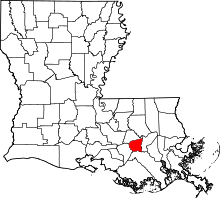 | |
| CDPs | ||
| Unincorporated community | ||
| Footnotes | ‡This populated place also has portions in an adjacent parish or parishes | |
This article is issued from
Wikipedia.
The text is licensed under Creative Commons - Attribution - Sharealike.
Additional terms may apply for the media files.