Parkside, Barrow-in-Furness
| Parkside | |
|---|---|
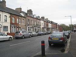 Ainslie Street east looking towards Barrow Park  | |
| Population | 5,584 (2011.Ward) |
| District | |
| Shire county | |
| Region | |
| Country | England |
| Sovereign state | United Kingdom |
| Post town | BARROW-IN-FURNESS |
| Postcode district | LA |
| Dialling code | 01229 |
| Police | Cumbria |
| Fire | Cumbria |
| Ambulance | North West |
| EU Parliament | North West England |
| UK Parliament | |
Parkside is an area and electoral ward of Barrow-in-Furness, Cumbria, England. It is bordered by Hindpool, Ormsgill, Hawcoat, Newbarns and Risedale and had a population of 5,742 in 2001,[1] reducing to 5,584 at the 2011 Census.[2] It is one of the town's most centralised wards and contains Barrow's main park (hence the ward's name), as well as the newly established Furness Academy. Abbey Road - Barrow's principal road runs down the entire western side of Parkside. The majority of housing to the west of Abbey Road is terraced and semi-detached, whilst the eastern side of Parkside is predominantly parkland and fields with the exception of some semi and detached housing. There are a number of place of worship in Parkside including Abbey Road Baptist Church, Spring Mount Christian Fellowship and Trinity Church Centre.[3] Barrow's first synagogue was founded in 1902 on Abbey Road although it closed less than twenty years later.[4]
Barrow Park
Demographics
| Vital statistics[1] | Parkside | Barrow-in-Furness | England |
|---|---|---|---|
| Religious individuals | 81.93% | 81.61% | 77.71% |
| Non-religious individuals | 11.11% | 10.79% | 14.59% |
| Religion withheld | 6.95% | 7.59% | 7.69% |
| Individuals in fairly good to good health |
89.99% | 86.75% | 90.97% |
| Individuals in bad health | 10.01% | 13.25% | 9.03% |
| People aged 16–74 who are economically active |
67.73% | 60.84% | 66.87% |
| People aged 16–74 who aren't economically active |
32.27% | 39.16% | 33.13% |
| People aged 16–74 with no qualifications |
24.52% | 32.82% | 28.85% |
References
- 1 2 "Parkside: Key Figures for 2001 Census". Office for National Statistics. Retrieved 2011-01-19.
- ↑ "Ward population 2011". Retrieved 13 June 2015.
- ↑ "Places of Worship in Barrow-in-Furness". GENUKI. Retrieved 2011-01-19.
- ↑ "Abbey Road/ Ainslie Street Synagogue". GENUKI. Retrieved 2011-01-19.
External links
Coordinates: 54°07′12″N 3°12′58″W / 54.120°N 3.216°W