Parkerville, Kansas
| Parkerville, Kansas | |
|---|---|
| City | |
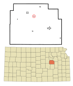 Location within Morris County and Kansas | |
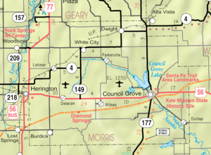 KDOT map of Morris County (legend) | |
| Coordinates: 38°45′53″N 96°39′45″W / 38.76472°N 96.66250°WCoordinates: 38°45′53″N 96°39′45″W / 38.76472°N 96.66250°W | |
| Country | United States |
| State | Kansas |
| County | Morris |
| Area[1] | |
| • Total | 0.12 sq mi (0.31 km2) |
| • Land | 0.12 sq mi (0.31 km2) |
| • Water | 0 sq mi (0 km2) |
| Elevation | 1,355 ft (413 m) |
| Population (2010)[2] | |
| • Total | 59 |
| • Estimate (2016)[3] | 56 |
| • Density | 490/sq mi (190/km2) |
| Time zone | UTC-6 (Central (CST)) |
| • Summer (DST) | UTC-5 (CDT) |
| FIPS code | 20-54575 [4] |
| GNIS feature ID | 0476886 [5] |
Parkerville is a city in Morris County, Kansas, United States. As of the 2010 census, the city population was 59.[6]
History
A post office was established in Parkersville on August 9, 1870, then renamed to Parkerville on June 23, 1892. The post office closed on October 31, 1953.[7] The city was incorporated as Parkerville in 1871.[8]
Parkerville was named for Charles G. Parker, a pioneer settler.[9]
Geography
Parkerville is located at 38°45′53″N 96°39′45″W / 38.76472°N 96.66250°W (38.764622, -96.662441).[10] According to the United States Census Bureau, the city has a total area of 0.12 square miles (0.31 km2), all of it land.[1]
Demographics
| Historical population | |||
|---|---|---|---|
| Census | Pop. | %± | |
| 1890 | 202 | — | |
| 1900 | 146 | −27.7% | |
| 1910 | 157 | 7.5% | |
| 1920 | 144 | −8.3% | |
| 1930 | 127 | −11.8% | |
| 1940 | 105 | −17.3% | |
| 1950 | 78 | −25.7% | |
| 1960 | 59 | −24.4% | |
| 1970 | 25 | −57.6% | |
| 1980 | 42 | 68.0% | |
| 1990 | 28 | −33.3% | |
| 2000 | 73 | 160.7% | |
| 2010 | 59 | −19.2% | |
| Est. 2016 | 56 | [3] | −5.1% |
| U.S. Decennial Census | |||
2010 census
As of the census[2] of 2010, there were 59 people, 25 households, and 17 families residing in the city. The population density was 491.7 inhabitants per square mile (189.8/km2). There were 32 housing units at an average density of 266.7 per square mile (103.0/km2). The racial makeup of the city was 81.4% White, 13.6% from other races, and 5.1% from two or more races. Hispanic or Latino of any race were 13.6% of the population.
There were 25 households of which 32.0% had children under the age of 18 living with them, 52.0% were married couples living together, 8.0% had a female householder with no husband present, 8.0% had a male householder with no wife present, and 32.0% were non-families. 24.0% of all households were made up of individuals and 4% had someone living alone who was 65 years of age or older. The average household size was 2.36 and the average family size was 2.82.
The median age in the city was 34.3 years. 22% of residents were under the age of 18; 8.6% were between the ages of 18 and 24; 37.4% were from 25 to 44; 20.4% were from 45 to 64; and 11.9% were 65 years of age or older. The gender makeup of the city was 50.8% male and 49.2% female.
2000 census
As of the census[4] of 2000, there were 73 people, 22 households, and 17 families residing in the city. The population density was 602.0 people per square mile (234.9/km²). There were 32 housing units at an average density of 263.9 per square mile (103.0/km²). The racial makeup of the city was 98.63% White, 1.37% from other races. Hispanic or Hispanic of any race were 6.85% of the population.
There were 22 households out of which 50.0% had children under the age of 18 living with them, 72.7% were married couples living together, 14.5% had a female householder with no husband present, and 22.7% were non-families. 18.2% of all households were made up of individuals and none had someone living alone who was 65 years of age or older. The average household size was 3.32 and the average family size was 3.94.
In the city, the population was spread out with 42.5% under the age of 18, 5.5% from 18 to 24, 23.3% from 25 to 44, 17.8% from 45 to 64, and 11.0% who were 65 years of age or older. The median age was 26 years. For every 100 females, there were 121.2 males. For every 100 females age 18 and over, there were 110.0 males.
The median income for a household in the city was $29,375, and the median income for a family was $32,188. Males had a median income of $17,292 versus $0 for females. The per capita income for the city was $9,792. None of the population and none of the families were below the poverty line.
Further reading
References
- 1 2 "US Gazetteer files 2010". United States Census Bureau. Archived from the original on January 24, 2012. Retrieved 2012-07-06.
- 1 2 "American FactFinder". United States Census Bureau. Retrieved 2012-07-06.
- 1 2 "Population and Housing Unit Estimates". Retrieved June 9, 2017.
- 1 2 "American FactFinder". United States Census Bureau. Archived from the original on September 11, 2013. Retrieved 2008-01-31.
- ↑ "US Board on Geographic Names". United States Geological Survey. 2007-10-25. Retrieved 2008-01-31.
- ↑ "2010 City Population and Housing Occupancy Status". U.S. Census Bureau. Archived from the original on July 21, 2011. Retrieved March 6, 2011.
- ↑ "Kansas Post Offices, 1828-1961". Kansas Historical Society. Retrieved 15 June 2014.
- ↑ History of the State of Kansas: Containing a Full Account of Its Growth from an Uninhabited Territory to a Wealthy and Important State. A. T. Andreas. 1883. p. 808.
- ↑ "Profile for Parkerville, Kansas". ePodunk. Retrieved 16 June 2014.
- ↑ "US Gazetteer files: 2010, 2000, and 1990". United States Census Bureau. 2011-02-12. Retrieved 2011-04-23.
External links
| Wikimedia Commons has media related to Parkerville, Kansas. |
- City
- Schools
- USD 481, local school district
- Historical
- Maps
Municipalities and communities of Morris County, Kansas, United States | ||
|---|---|---|
| Cities | 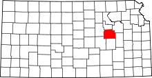 | |
| Unincorporated communities | ||
| Ghost towns |
| |
| Townships |
| |
| Footnotes | ‡This populated place also has portions in an adjacent county or counties | |