Pantelimon, Bucharest
Pantelimon is a neighbourhood located in north-eastern Bucharest, Romania, in Sector 2. Outside Bucharest, there is an adjacent town named Pantelimon, administered separately.
The Pantelimon district is named after Saint Pantaleon (Pantelimon in Romanian), and hosts Arena Națională, the largest football stadium in Romania. Pantelimon Avenue is the backbone of the district.
A Cora hypermarket is situated in this neighbourhood. Several car showrooms (Renault & Dacia, Peugeot, Skoda, Fiat) have been built in the east side of the district.
The area was a small houses neighborhood until systematisation started in 1971. The first apartment blocks were completed in 1974, followed by the completion of the "Delfinului" apartments in 1976-1978, construction having continued until the 1980s.
A famous area of the district is "Capătu' lu' 14" (or "Capu' lu' 14", literally "the terminus of (tram) line 14"), which is situated in the east side of the neighbourhood. This area is the setting of a popular legend among locals, "The Children's Fall." The story — which dates back to the mid-1950s, when the area suffered from gangster and racketeering problems — details the supposed decline of the neighbourhood's children from being "legit" to being "dangerous".[1] Pantelimon is also famous in Romania because of the hip-hop group B.U.G. Mafia. As children, the members of the band lived on Pantelimon Alley and Socului, near "Capătu' lu" 14". Tataee, a member of B.U.G. Mafia stated in various interviews that both he and Uzzi and Daddy Caddy still live in the neighbourhood.
The east side of the neighbourhood was built on the domains of the Mărcuța Monastery. The old Mărcuţa church built in 1587 still exists today on the banks of Pantelimon lake.
Pantelimon is served by the Pantelimon and Republica subway stations, as well as tram lines 14, 23, 36, 40, 46, 55, 56 and bus lines 101, 104, 243, 330, 335.
Currently, there are 5 primary and 2 secondary schools (Lucian Blaga Theoretical High School and Saint Pantaleon Industrial School Group) in the neighbourhood.
Coordinates: 44°26′33.48″N 26°9′32.83″E / 44.4426333°N 26.1591194°E
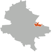 Pantelimon on the map of Bucharest
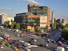 Postăvăria Româna building (1978-1979)
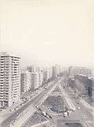 Pantelimon under communism, 1980s
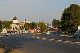 DN3 in Pantelimon (adjactent town)
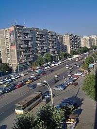 Apartment blocks in Pantelimon
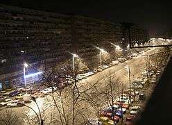 Pantelimon Avenue, during night time, with first apartment blocks from 1974
| Wikimedia Commons has media related to Pantelimon, Bucharest. |
| Sectors of Bucharest |  | |
|---|---|---|
| Districts (quarters) |
| |
| Squares | ||
| Major streets | ||
| Hills | ||
| Rivers | ||
| Lakes |
| |
| Parks and forests | ||
| See also | ||
References
- ↑ "Archived copy". Archived from the original on 2007-12-21. Retrieved 2008-08-01.