Pangnirtung Airport
| Pangnirtung Airport | |||||||||||
|---|---|---|---|---|---|---|---|---|---|---|---|
 | |||||||||||
| Summary | |||||||||||
| Airport type | Public | ||||||||||
| Operator | Government of Nunavut | ||||||||||
| Location | Pangnirtung, Nunavut | ||||||||||
| Time zone | EST (UTC−05:00) | ||||||||||
| • Summer (DST) | EDT (UTC−04:00) | ||||||||||
| Elevation AMSL | 79 ft / 24 m | ||||||||||
| Coordinates | 66°08′42″N 065°42′49″W / 66.14500°N 65.71361°WCoordinates: 66°08′42″N 065°42′49″W / 66.14500°N 65.71361°W | ||||||||||
| Map | |||||||||||
 CYXP Location in Nunavut | |||||||||||
| Runways | |||||||||||
| |||||||||||
| Statistics (2010) | |||||||||||
| |||||||||||
Pangnirtung Airport (IATA: YXP, ICAO: CYXP) is located at Pangnirtung, Nunavut, Canada, and is operated by the Government of Nunavut.
In December 2005 the Government of Nunavut announced that they would spend $34.6 million to build a new airport.[4]
Airlines and destinations
| Airlines | Destinations |
|---|---|
| Canadian North | Iqaluit, Qikiqtarjuaq[5] |
| First Air | Iqaluit, Qikiqtarjuaq[6] |
Gallery
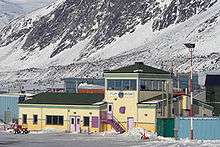
Pangnirtung Airport
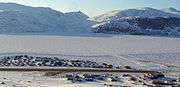
Pangnirtung airstrip, April 2006
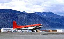
Douglas Super DC-3, taking off from Pangnirtung Airport
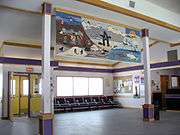
Interior of the terminal, showing the tapestry woven for the opening of the airport terminal, April 2006
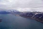
Abeam the Pangnirtung Airport
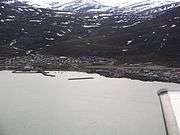
The town and airport snuggled in beside the mountains
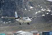
Air Labrador de Havilland Canada DHC-6 Twin Otter on short final for runway 24
References
- ↑ Canada Flight Supplement. Effective 0901Z 19 July 2018 to 0901Z 13 September 2018.
- ↑ Synoptic/Metstat Station Information
- ↑ Total aircraft movements by class of operation
- ↑ Nunatsiaq News
- ↑ Flight Schedule and Route Map Archived 2011-07-08 at the Wayback Machine..
- ↑ First Air Flight Schedule
External links
| Wikimedia Commons has media related to Pangnirtung Airport. |
- Past three hours METARs, SPECI and current TAFs for Pangnirtung Airport from Nav Canada as available.
| By name | |
|---|---|
| By location indicator | |
| By province/territory | |
| By area | |
| National Airports System | |
| Related | |
| |
This article is issued from
Wikipedia.
The text is licensed under Creative Commons - Attribution - Sharealike.
Additional terms may apply for the media files.