Pangkajene and Islands Regency
| Pangkajene & Islands Regency Kabupaten Pangkajene Dan Kepulauan | ||
|---|---|---|
| Regency | ||
| ||
| Country | Indonesia | |
| Province | South Sulawesi | |
| Capital | Pangkajene | |
| Area | ||
| • Total | 1,236.27 km2 (477.33 sq mi) | |
| Population | ||
| • Total | 305,758 | |
| • Density | 250/km2 (640/sq mi) | |
| Time zone | UTC+8 (WITA) | |
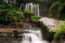
Padang Lampe Waterfall
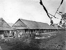
Barracks in Pangkajene (Pankajene)
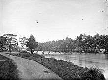
River and bridge in Pankajene
Pangkajene Islands Regency (more accurately Pangkajene and Islands Regency - Kabupaten Pangkajene Dan Kepulauan) is a regency of South Sulawesi Province of Indonesia. Notwithstanding the name, the regency lies primarily on the mainland of Sulawesi's southern peninsula, but includes the Spermonds Islands (Kepulauan Spermonde) off the west coast of that peninsula. The principal town lies at Pangkajene, but there are a series of further towns like Lejang, Labakkang, Bontobonto and Segeri proceeding northwards from Pangkajene along the Trans-Sulawesi Highway.
Administration
The Regency in 2010 comprised thirteen administrative Districts (Kecamatan), tabulated below with their 2010 Census population.[1]
| Name | Population Census 2010 |
|---|---|
| Liukang Tangaya | 18,318 |
| Liukang Kalmas | 12,920 |
| Liukang Tupabbiring | 16,895 |
| Liukang Tupabbiring Utara | 12,343 |
| Pangkajene district | 41,701 |
| Minasatene | 32,970 |
| Balocci | 15,450 |
| Tondong Tallasa | 8,637 |
| Bungoro | 38,851 |
| Labakkang | 43,730 |
| Ma'rang | 29,915 |
| Segiri | 20,037 |
| Mandalle | 13,870 |
References
- ↑ Biro Pusat Statistik, Jakarta, 2011.
Regencies and cities of South Sulawesi | ||
|---|---|---|
Capital: Makassar | ||
| Regencies |  | |
| Cities | ||
| Wikimedia Commons has media related to Pangkajene and Islands Regency. |
This article is issued from
Wikipedia.
The text is licensed under Creative Commons - Attribution - Sharealike.
Additional terms may apply for the media files.