Pandrangi
| Pandrangi | |
|---|---|
| Village | |
 Pandrangi Village | |
 Pandrangi Location in Andhra Pradesh, India  Pandrangi Pandrangi (India) | |
| Coordinates: 17°59′00″N 83°20′00″E / 17.9833°N 83.3333°ECoordinates: 17°59′00″N 83°20′00″E / 17.9833°N 83.3333°E | |
| Country |
|
| State | Andhra Pradesh |
| District | Visakhapatnam |
| Elevation | 23 m (75 ft) |
| Languages | |
| • Official | Telugu |
| Time zone | UTC+5:30 (IST) |
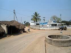
Pandrangi is a village in Padmanabham mandal in the Visakhapatnam district of Andhra Pradesh, India.[1]
Geography
Pandrangi is located at 17°59′00″N 83°20′00″E / 17.9833°N 83.3333°E.[2] It has an average elevation of 23 meters (78 feet).[3][4][5][6]
References
- ↑ "Mandal wise list of villages in Visakhapatnam district" (PDF). Chief Commissioner of Land Administration. National Informatics Centre. Archived from the original (PDF) on 19 March 2015. Retrieved 6 March 2016.
- ↑ Falling Rain Genomics.Padmanabham
- ↑ http://dsal.uchicago.edu/reference/gazetteer/pager.html?objectid=DS405.1.I34_V19_316.gif
- ↑ Book named SRI ANDHRA KSHATRIYA VAMSARATNAKARAM - Page No.s: 642 & 643 about RAJA SAGI Family in Pandrangi Village, Padmanabham Mandal, Visakhapatnam District, and was Written & Published by Mr. Sri Buddharaju Varahalaraju in 1980. Based on this reference and also according to the history,the above article about RAJA SAGI Family and Padmanabham in this page were written. - Raja Sagi Sri Harsha Varma
- ↑ Historical Sketches of Ancient Dekhan By Kandadai Vaidyanatha Subrahmanya Aiyer
- ↑ Andhra Between the Empires. Y. Sudershan Rao Suleka Publishers, Hanamankonda 1991 pg 7
This article is issued from
Wikipedia.
The text is licensed under Creative Commons - Attribution - Sharealike.
Additional terms may apply for the media files.