Paluan, Occidental Mindoro
| Paluan | ||
|---|---|---|
| Municipality | ||
| Municipality of Paluan | ||
| ||
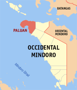 Map of Occidental Mindoro with Paluan highlighted | ||
.svg.png) Paluan Location within the Philippines | ||
| Coordinates: 13°25′N 120°28′E / 13.42°N 120.47°ECoordinates: 13°25′N 120°28′E / 13.42°N 120.47°E | ||
| Country |
| |
| Region | Mimaropa (Region IV-B) | |
| Province | Occidental Mindoro | |
| District | Lone District | |
| Founded | January 5, 1901 | |
| Barangays | 12 | |
| Government [1] | ||
| • Type | Sangguniang Bayan | |
| • Mayor | Carl Michael Pangilinan | |
| • Electorate | 10,474 voters (2016) | |
| Area [2] | ||
| • Total | 564.50 km2 (217.95 sq mi) | |
| Population (2015 census)[3] | ||
| • Total | 16,025 | |
| • Density | 28/km2 (74/sq mi) | |
| Time zone | UTC+8 (PST) | |
| ZIP code | 5107 | |
| PSGC | 175107000 | |
| IDD : area code | +63 (0)43 | |
| Climate type | Tropical climate | |
| Income class | 3rd municipal income class | |
| Revenue (₱) | 129,876,580.30 (2016) | |
| Native languages |
Iraya Tagalog | |

Paluan, officially the Municipality of Paluan, is a 3rd class municipality in the province of Occidental Mindoro, Philippines. According to the 2015 census, it has a population of 16,025 people.[3]
Geography
The town is located at the north-western tip of Mindoro Island. It lies along the north-east shore of Paluan Bay, approximately 7 miles southeast of Cape Calavite, a major sea-lane for inter-island and ocean-going vessels. The town is surrounded by rolling and steep mountain ranges, of which Mount Calavite with an altitude of 1,491 metres (4,892 ft)[4] is the highest peak. At Mount Calavite point, the best panoramic view of Occidental Mindoro and nearby islands could be seen.
Paluan is a predominantly rural municipality, characterized by natural vegetation and an economy based mostly on agriculture. Its dominant land use is forest cover. Forestland occupies 31,826 hectares (78,640 acres) or 56% of total land area, planted with patches of fruit bearing trees and upland field crops. A large portion of forestland is restricted as a preservation area for wildlife and watershed, the 181.5 square kilometres (70.1 sq mi) Mount Calavite Wildlife Sanctuary. This area, which also includes Mount Calavite, is a habitat of various flora and fauna, such as the rare Mindoro tamaraw and the critically endangered Mindoro bleeding-heart (Gallicolumba platenae).[5] Paluan has a 18,016.19 hectares (44,519.0 acres) of land classified as National Integrated Protected Areas System (NIPAS) area.
Agricultural lands cover 13,842 hectares (34,200 acres) or 24% of the total land area. About 17% is devoted to rice production while 4% is planted with upland crops such as vegetables and root crops, yet 80% or 10,897 hectares (26,930 acres) of agricultural land remains uncultivated. Open grasslands cover 18% or 10,428 hectares (25,770 acres) utilized for pasture.
Barangays
Paluan is politically subdivided into 12 barangays.
- Alipaoy
- Harrison
- Lumangbayan
- Mananao
- Marikit
- Mapalad Pob. (Bgy. 1)
- Handang Tumulong Pob. (Bgy. 2)
- Silahis Ng Pag-Asa Pob. (Bgy. 3)
- Pag-Asa Ng Bayan Pob. (Bgy. 4)
- Bagong Silang Pob. (Bgy. 5)
- San Jose Pob. (Bgy. 6)
- Tubili
History
Paluan became a municipality on January 5, 1901, but its history dates back to the early 17th century when the village was known as the Religious District of Calavite.
Demographics
| Population census of Paluan | ||
|---|---|---|
| Year | Pop. | ±% p.a. |
| 1903 | 1,345 | — |
| 1918 | 2,418 | +3.99% |
| 1939 | 3,305 | +1.50% |
| 1948 | 2,718 | −2.15% |
| 1960 | 4,597 | +4.48% |
| 1970 | 5,383 | +1.59% |
| 1975 | 7,346 | +6.43% |
| 1980 | 7,438 | +0.25% |
| 1990 | 7,549 | +0.15% |
| 1995 | 11,234 | +7.73% |
| 2000 | 12,023 | +1.47% |
| 2007 | 13,718 | +1.84% |
| 2010 | 15,223 | +3.86% |
| 2015 | 16,025 | +0.98% |
| Source: Philippine Statistics Authority[3][6][7][8] | ||
References
- ↑ "Municipality". Quezon City, Philippines: Department of the Interior and Local Government. Retrieved 31 May 2013.
- ↑ "Province: Occidental Mindoro". PSGC Interactive. Quezon City, Philippines: Philippine Statistics Authority. Retrieved 12 November 2016.
- 1 2 3 Census of Population (2015). "Region IV-B (Mimaropa)". Total Population by Province, City, Municipality and Barangay. PSA. Retrieved 20 June 2016.
- ↑ "Mount Calavite". Peakery.com. Retrieved 1 November 2012.
- ↑ "PH037 - Mount Calavite Wildlife Sanctuary". Sites - Important Bird Areas (IBAs). BirdLife International. Retrieved 1 November 2012.
- ↑ Census of Population and Housing (2010). "Region IV-B (Mimaropa)". Total Population by Province, City, Municipality and Barangay. NSO. Retrieved 29 June 2016.
- ↑ Censuses of Population (1903–2007). "Region IV-B (Mimaropa)". Table 1. Population Enumerated in Various Censuses by Province/Highly Urbanized City: 1903 to 2007. NSO.
- ↑ "Province of Occidental Mindoro". Municipality Population Data. Local Water Utilities Administration Research Division. Retrieved 17 December 2016.
External links
- Philippine Standard Geographic Code
- Philippine Census Information
- Local Governance Performance Management System
Places adjacent to Paluan, Occidental Mindoro | |
|---|---|
Mamburao (capital) | |
| Municipalities | |