Pakala, Chittoor district
- Not to be confused with Pakala (Prakasam district).
| Pakala | |
|---|---|
| Village | |
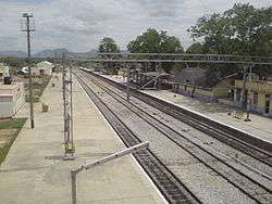 Pakala Railway Station view from foot over bridge | |
 Pakala Location in Andhra Pradesh, India  Pakala Pakala (India) | |
| Coordinates: 13°28′00″N 79°07′00″E / 13.4667°N 79.1167°ECoordinates: 13°28′00″N 79°07′00″E / 13.4667°N 79.1167°E | |
| Country | India |
| State | Andhra Pradesh |
| District | Chittoor |
| Mandal | Pakala |
| Elevation | 361 m (1,184 ft) |
| Languages | |
| • Official | Telugu |
| Time zone | UTC+5:30 (IST) |
Pakala is a major town in Chittoor district of the Indian state of Andhra Pradesh. It is the mandal headquarters of Pakala mandal.[1]
It comes under the political constituency of Chandragiri.
Demographics
Population (2001)
- 21888 males
- 10953 females
- 10935 lives in 5109 houses.
- Area 2710 hectares
Geography
Pakala is located at 13°28′00″N 79°07′00″E / 13.4667°N 79.1167°E.[2] It has an average elevation of 361 meters (1184 feet).
Transport
Pakala is well connected with Tirupati and Chittoor by Road as well as Railways. The nearest airport is Tirupati Airport. The village is served by Pakala Junction railway station.[3]
References
- ↑ "Chittoor District Mandals" (PDF). Census of India. pp. 472, 514. Retrieved 19 June 2015.
- ↑ "Maps, Weather, and Airports for Pakala, India". fallingrain.com.
- ↑ govt. of india. "Sub-District Details". censusindia.gov.in. Retrieved 15 August 2016.
This article is issued from
Wikipedia.
The text is licensed under Creative Commons - Attribution - Sharealike.
Additional terms may apply for the media files.