Padua Airport
| Padua “Gino Allegri” Airport Aeroporto di Padova “Gino Allegri” | |||||||||||
|---|---|---|---|---|---|---|---|---|---|---|---|
 | |||||||||||
| Summary | |||||||||||
| Airport type | Civil and militar | ||||||||||
| Serves | Padua | ||||||||||
| Location | Via Sorio, 89 – 35141 | ||||||||||
| Elevation AMSL | 44 ft / 13 m | ||||||||||
| Coordinates | 45°23′45″N 11°50′53″E / 45.39583°N 11.84806°ECoordinates: 45°23′45″N 11°50′53″E / 45.39583°N 11.84806°E | ||||||||||
| Website |
www | ||||||||||
| Map | |||||||||||
 LIPU Location in Italy | |||||||||||
| Runways | |||||||||||
| |||||||||||
|
Sources: World Aero Data[1] | |||||||||||
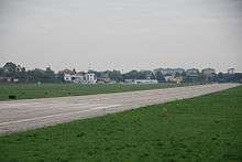
Padua “Gino Allegri” Airport (Italian: Aeroporto di Padova “Gino Allegri”) (ICAO: LIPU) is an airport serving Padua, Veneto, Italy.
The airport is named after Gino Allegri, an Italian aviatior who lost his life while attempting to land in a small airfield in the Province of Padua during World War I.[2]
See also


- List of airports in Italy
References
- ↑ Airport information for Padua Airport at World Aero Data. Data current as of October 2006.
- ↑ "Archived copy". Archived from the original on 2012-02-05. Retrieved 2012-04-20.
External links
- Gino Allegri Airport official website
- Airport information for Padua Airport at Great Circle Mapper. Source: DAFIF (effective October 2006).
This article is issued from
Wikipedia.
The text is licensed under Creative Commons - Attribution - Sharealike.
Additional terms may apply for the media files.