Packwaukee (CDP), Wisconsin
| Packwaukee, Wisconsin | |
|---|---|
| Census-designated place | |
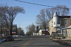 Looking north in downtown Packwaukee | |
 Packwaukee, Wisconsin | |
| Coordinates: 43°45′48″N 89°27′30″W / 43.76333°N 89.45833°WCoordinates: 43°45′48″N 89°27′30″W / 43.76333°N 89.45833°W | |
| Country | United States |
| State | Wisconsin |
| County | Marquette |
| Area | |
| • Total | 0.480 sq mi (1.24 km2) |
| • Land | 0.480 sq mi (1.24 km2) |
| • Water | 0 sq mi (0 km2) |
| Elevation | 781 ft (238 m) |
| Population (2010) | |
| • Total | 262 |
| • Density | 550/sq mi (210/km2) |
| Time zone | UTC-6 (Central (CST)) |
| • Summer (DST) | UTC-5 (CDT) |
| ZIP code | 53953 |
| Area code(s) | 608 |
| GNIS feature ID | 1570986[1] |
Packwaukee is an unincorporated census-designated place located in the town of Packwaukee, Marquette County, Wisconsin, United States. Packwaukee is located on the north bank of Buffalo Lake, a lake on the Fox River; it is 7 miles (11 km) west-southwest of Montello. Packwaukee has a post office with ZIP code 53953.[2] As of the 2010 census, its population was 262.[3]
Images
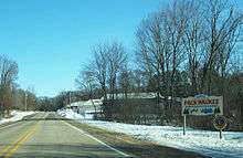 Sign
Sign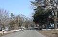 Looking east
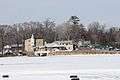 Panorama across Buffalo Lake on the Fox River
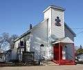 Presbyterian church
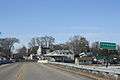 Sign on County D
References
| Wikimedia Commons has media related to Packwaukee, Wisconsin. |
Municipalities and communities of Marquette County, Wisconsin, United States | ||
|---|---|---|
| City | 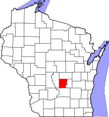 | |
| Villages | ||
| Towns | ||
| CDP | ||
| Unincorporated communities | ||
This article is issued from
Wikipedia.
The text is licensed under Creative Commons - Attribution - Sharealike.
Additional terms may apply for the media files.