Pa Sang District
| Pa Sang ป่าซาง | |
|---|---|
| Amphoe | |
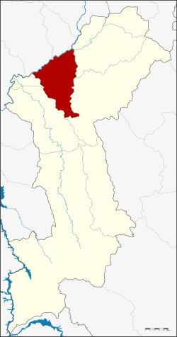 Amphoe location in Lamphun Province | |
| Coordinates: 18°31′33″N 98°56′21″E / 18.52583°N 98.93917°ECoordinates: 18°31′33″N 98°56′21″E / 18.52583°N 98.93917°E | |
| Country | Thailand |
| Province | Lamphun |
| Seat | Pa Sang |
| Area | |
| • Total | 299.9 km2 (115.8 sq mi) |
| Population (2015) | |
| • Total | 55,824 |
| • Density | 195.5/km2 (506/sq mi) |
| Time zone | UTC+7 (ICT) |
| Postal code | 51120 |
| Geocode | 5106 |
Pa Sang (Thai: ป่าซาง; IPA: [pàː sāːŋ]) is a district (amphoe) of Lamphun Province, northern Thailand.
Geography
Neighboring districts are (from the east clockwise) Mueang Lamphun, Mae Tha, Ban Hong and Wiang Nong Long of Lamphun Province, Doi Lo and San Pa Tong of Chiang Mai Province.
History
Originally named Pak Bong after its central sub-district, the district was renamed Pa Sang in 1953.[1]
Ethnic groups
The district is home to a population of Yong people. They migrated from Muang Yong of Shan State of today's Myanmar to the northern part of Thailand in 1805 or in the early-Rattanakosin period. Yong women are known as skillful cloth weavers.[2]
Administration
Central administration
Pa Sang District is divided into nine sub-districts (tambon), which are further subdivided into 90 administrative villages (Muban).
| No. | Name | Thai | Villages | Pop.[3] |
|---|---|---|---|---|
| 1. | Pak Bong | ปากบ่อง | 5 | 3,415 |
| 2. | Pa Sang | ป่าซาง | 5 | 5,450 |
| 3. | Mae Raeng | แม่แรง | 11 | 7,368 |
| 4. | Muang Noi | ม่วงน้อย | 8 | 4,466 |
| 5. | Ban Ruean | บ้านเรือน | 8 | 4,059 |
| 6. | Makok | มะกอก | 9 | 5,361 |
| 7. | Tha Tum | ท่าตุ้ม | 14 | 7,345 |
| 8. | Nam Dip | น้ำดิบ | 17 | 9,592 |
| 11. | Nakhon Chedi | นครเจดีย์ | 13 | 8,768 |
Missing numbers are tambon which now form Wiang Nong Long district.
Local administration
There are four sub-district municipalities (Thesaban Tambon) in the district:
- Pa Sang (Thai: เทศบาลตำบลป่าซาง) consisting of sub-district Pak Bong, Pa Sang.
- Muang Noi (Thai: เทศบาลตำบลม่วงน้อย) consisting of sub-district Muang Noi.
- Mae Raeng (Thai: เทศบาลตำบลแม่แรง) consisting of sub-district Mae Raeng.
- Makok (Thai: เทศบาลตำบลมะกอก) consisting of sub-district Makok.
There are four sub-district administrative organizations (SAO) in the district:
- Ban Ruean (Thai: องค์การบริหารส่วนตำบลบ้านเรือน) consisting of sub-district Ban Ruean.
- Tha Tum (Thai: องค์การบริหารส่วนตำบลท่าตุ้ม) consisting of sub-district Tha Tum.
- Nam Dip (Thai: องค์การบริหารส่วนตำบลน้ำดิบ) consisting of sub-district Nam Dip.
- Nakhon Chedi (Thai: องค์การบริหารส่วนตำบลนครเจดีย์) consisting of sub-district Nakhon Chedi.
References
- ↑ พระราชกฤษฎีกาเปลี่ยนชื่ออำเภอและตำบลบางแห่ง พ.ศ. ๒๔๙๖ (PDF). Royal Gazette (in Thai). 70 (25 ก): 492. April 14, 1953.
- ↑ Karnjanatawe, Karnjana (11 January 2018). "Thailand's cotton belt". Bangkok Post. Retrieved 11 January 2018.
- ↑ "Population statistics 2015" (in Thai). Department of Provincial Administration. Retrieved 2016-04-21.
External links
- amphoe.com (Thai)