Puerto Rico Highway 12
| ||||
|---|---|---|---|---|
 | ||||
| Route information | ||||
| Maintained by Puerto Rico DTPW | ||||
| Length | 5.28 km[1] (3.28 mi) | |||
| Existed | 1960[2][lower-alpha 1] – present | |||
| Major junctions | ||||
| South end | Port of Ponce | |||
| North end |
| |||
| Highway system | ||||
| ||||


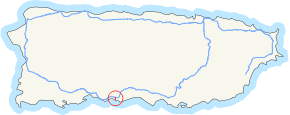
Puerto Rico Highway 12, also called Avenida Malecon,[3] and Avenida Santiago de los Caballeros, is a 5.28-kilometer,[1] limited-access highway entirely located within the city limits of Ponce, Puerto Rico, and connecting Puerto Rico Highway 14 to the La Guancha area in Barrio Playa in Ponce. It is similar to a freeway but has one traffic light near its intersection with PR-14. In addition to its northern and southern terminus, the highway has four full interchange exits: PR-52, PR-2, PR-133/Calle Comercio, and Avenida Las Américas. Since PR-12's southern terminus is at the Port of Ponce, its traffic volume is expected to grow as construction in the new Port of the Americas is completed.[4]
%2C_en_Ponce%2C_PR_(DSC01665).jpg)
.svg.png)
History
The 2.5 kilometer section of this road, from the Ponce Bypass to just a few feet from the Caribbean Sea at PR-123, was the first segment built; it was built in 1960.[5] It was called "Avenida Malecon" (Pier Avenue), as it lead from the then-urbanized area of Ponce to the Ponce wharf. The segment north of PR-2, that is, between PR-2 and Avenida Tito Castro was built in the 1990s, and completed in 2002, as part of the Ponce en Marcha project.[6]
PR-12 used to be signed as part of 'PR-14' before construction of the new PR-10 took place. The PR-14 signing has since been moved into another route (ending at Monumento a la abolición de la esclavitud, near downtown Ponce, while the PR-12 signing was assigned to the southernmost 5.28 kilometers of the old PR-14 route. As of 2008, the Puerto Rico Department of Transportation and Public Works had not yet updated the signing on the road, but by 2011 it had.
Junction list
| Municipality | Location | km[7][8] | mi | Destinations | Notes |
|---|---|---|---|---|---|
| Ponce | 0.00 | 0.00 | At-grade intersection | ||
| 0.30 | 0.19 | Calle Obispado – Ponce | At-grade intersection | ||
| 0.50 | 0.31 | Southbound only | |||
| 1.50 | 0.93 | ||||
| 2.00 | 1.24 | ||||
| 2.80 | 1.74 | ||||
| 3.20 | 1.99 | Avenida Rafael Cordero Santiago – Ponce | |||
| 3.40 | 2.11 | ||||
| 4.60 | 2.86 | Avenida Caribe – Playa | Left exit; eastbound only | ||
| 4.90 | 3.04 | Puerto Viejo – Playa | Right exit; westbound only | ||
| 5.28 | 3.28 | ||||
| 1.000 mi = 1.609 km; 1.000 km = 0.621 mi | |||||
Gallery
 2008 PR-12 photo with old PR-14 signing
Notes
See also
References
- 1 2 Guía de Carreteras Principales, Expresos y Autopistas. (In Spanish) Puerto Rico Autoridad de Carreteras y Transportacion (ACT).
- ↑ Carmelo Rosario Natal. Ponce En Su Historia Moderna: 1945-2002. Published by Secretaría de Cultura y Turismo of the Government of the Autonomous Municipality of Ponce. Ponce, Puerto Rico. 2003. p. 53.
- ↑ General Purpose Population Data, Census 2000. Unidad de Sistemas de Información Geográfica, Área de Tecnología de Información Gubernamental, Oficina de Gerencia y Presupuesto. Gobierno de Puerto Rico. Archived 12 August 2010 at the Wayback Machine. Retrieved March 15, 2010.
- ↑ Links to Port of the Americas
- ↑ Carmelo Rosario Natal. Ponce En Su Historia Moderna: 1945-2002. Published by Secretaría de Cultura y Turismo of the Government of the Autonomous Municipality of Ponce. Ponce, Puerto Rico. 2003. p. 53.
- ↑ Neysa Rodriguez Deynes. Brevario sobre la Historia de Ponce. Published by Oficina de Cultura y Turismo of the Government of the Autonomous Municipality of Ponce. Ponce, Puerto Rico. 2002. p. 111.
- ↑ Guia de Carreteras Principales, Expresos y Autopistas. Government of Puerto Rico. Department of Transportation and Public Works. 17 November 2010.
- ↑ Highways and Transportation Authority. Office of Traffic Data Compilation and Analysis. (2010). Transito Promedio Diario [Average Daily Traffic (AADT)] (PDF) (Report) (in Spanish). San Juan, PR: Department of Transportation and Public Works. pp. 28–30.