Oumé Department
| Oumé Department Département d'Oumé | |
|---|---|
| Department | |
 Location in Ivory Coast. Oumé Department has retained the same boundaries since its creation in 1980. | |
| Country |
|
| District | Gôh-Djiboua |
| Region | Gôh |
| 1980 | Established as a first-level subdivision via a division of Gagnoa Dept |
| 1997 | Converted to a second-level subdivision |
| 2000 | Transferred to the new Fromager Region |
| 2011 | Converted to a third-level subdivision |
| Departmental seat | Oumé |
| Government[1] | |
| • Prefect | François Dogbo Labé |
| Population (2014) | |
| • Total | 274,020[2] |
| Time zone | UTC+0 (GMT) |
Oumé Department is a department of Gôh Region in Gôh-Djiboua District, Ivory Coast. In 2014, its population was 274,020 and its seat is the settlement of Oumé. The sub-prefectures of the department are Diégonéfla, Guépahouo, Oumé, and Tonla.
History
Oumé Department was created in 1980 as a split-off from Gagnoa Department.[3]
In 1997, regions were introduced as new first-level subdivisions of Ivory Coast; as a result, all departments were converted into second-level subdivisions. Oumé Department was initially included in Marahoué Region, but in 2000 Oumé Department was combined with Haut-Sassandra's Gagnoa Department to create Fromager Region.
In 2011, districts were introduced as new first-level subdivisions of Ivory Coast. At the same time, regions were reorganised and became second-level subdivisions and all departments were converted into third-level subdivisions. At this time, Oumé Department became part of Gôh Region in Gôh-Djiboua District.
Notes
- ↑ "Préfets de Région et de Préfets de Département (Conseil des ministres du mercredi 26 septembre 2012)", abidjan.net, 2 October 2012.
- ↑ "Côte d'Ivoire". geohive.com. Retrieved 5 December 2015.
- ↑ "Regions of Côte d'Ivoire (Ivory Coast)", statoids.com, accessed 16 February 2016.
Regional seat: Gagnoa | ||
| Gagnoa Department | 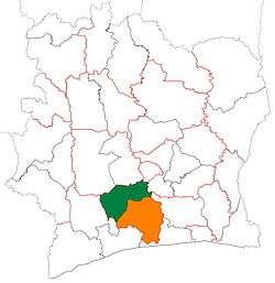 | |
| Oumé Department | ||
* also a commune | ||
Coordinates: 6°23′N 5°25′W / 6.383°N 5.417°W