Otterøya
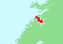 | |
 Otterøya Location of the island  Otterøya Otterøya (Norway) | |
| Geography | |
|---|---|
| Location | Trøndelag, Norway |
| Coordinates | 64°29′30″N 11°21′22″E / 64.4918°N 11.3561°ECoordinates: 64°29′30″N 11°21′22″E / 64.4918°N 11.3561°E |
| Area | 143 km2 (55 sq mi) |
| Length | 25 km (15.5 mi) |
| Width | 6 km (3.7 mi) |
| Highest elevation | 446 m (1,463 ft) |
| Highest point | Tømmervikfjellet |
| Administration | |
|
Norway | |
| County | Trøndelag |
| Municipality | Namsos |
| Demographics | |
| Population | 809 (2001) |
Otterøya is an island in the municipality of Namsos in Trøndelag county, Norway. The 143-square-kilometre (55 sq mi) island is the largest island in the northern part of Trøndelag county. Otterøya sits just to the northwest of the town of Namsos on the north side of the Namsenfjorden. It is connected to the mainland by the Lokkaren Bridge. The island was once governed by the municipalities of Otterøy and Fosnes, but became a part of the municipality of Namsos in 1964. Otterøy Church is located on the island.[1]
Notable residents
- Idar Lind (born 1954), a Norwegian writer
See also
References
- ↑ Thorsnæs, Geir, ed. (2014-06-25). "Otterøya – Namsos". Store norske leksikon (in Norwegian). Kunnskapsforlaget. Retrieved 2018-04-21.
| Authority control |
|---|
This article is issued from
Wikipedia.
The text is licensed under Creative Commons - Attribution - Sharealike.
Additional terms may apply for the media files.