Otoyol 32
| ||||
|---|---|---|---|---|
| Otoyol 32 | ||||
| İzmir-Çeşme Otoyolu | ||||
 | ||||
| Route information | ||||
|
Part of | ||||
| Length | 77.7 km (48.3 mi) | |||
| Existed | 1997 – present | |||
| Major junctions | ||||
| East end | M.K. Coastal Blvd. in Balçova, İzmir | |||
| ||||
| West end | 2122nd St. in Çeşme | |||
| Location | ||||
| Regions: | Aegean | |||
| Provinces | İzmir | |||
| Major cities | İzmir | |||
| Highway system | ||||
| ||||

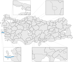
Otoyol 32 (English: Motorway 3), also known as the Izmir-Çeşme Motorway (Turkish: İzmir-Çeşme Otoyolu), or just as the Çeşme Motorway and abbreviated as the O-32 is a 77.7 km (48.3 mi) long toll motorway located entirely within the Izmir Province in Turkey. The O-32 runs from Balçova, Izmir to the coastal resort town of Çeşme on the Karaburun Peninsula. The motorway connects to the O-30 (Izmir Beltway) in Izmir.
The motorway serves towns situated on the southern shore of the Gulf of Izmir as well as summer houses and resort towns towards its western end. The campus of the Izmir Institute of Technology (İYTE) is located just off the O-32 as well as the İzmir Technology Development Zone[1]
Construction of the Izmir-Çeşme Motorway began in December 1989 and was completed in 1992.
Exit list
| Province | District | km | mi | Exit | Destinations | Notes |
|---|---|---|---|---|---|---|
| İzmir | Balçova | 0.0 | 0.0 | Mustafa Kemal Coastal Blvd. – Konak | ||
| 0.9 | 0.56 | K1 | ||||
| Narlıdere | 6.4 | 4.0 | K2 | |||
| Güzelbahçe | 18.9 | 11.7 | K3 | 35-39 — Seferihisar | ||
| Urla | 19.2 | 11.9 | Şirinkent Toll Plaza | |||
| 28.3 | 17.6 | K4 | Urla connector — Urla | |||
| 37.1 | 23.1 | K5 | ||||
| 49.5 | 30.8 | K6 | ||||
| Çeşme | 66.4 | 41.3 | K7 | Alaçatı connector — Alaçatı | Connector to | |
| 75.2 | 46.7 | Çeşme Toll Plaza | ||||
| 75.7 | 47.0 | K8 | 7000th St. — Musalla | |||
| 77.7 | 48.3 | K9 | 2122nd St. — Çeşme | |||
1.000 mi = 1.609 km; 1.000 km = 0.621 mi
| ||||||
See also
References
- ↑ İzmir Technology Development Zone Archived 2008-03-16 at the Wayback Machine.
Coordinates: 38°17′57″N 26°38′30″E / 38.29917°N 26.64167°E
| Current | |
|---|---|
| Former | |
| Under construction | |
| Planned |
|
| |
| Wikimedia Commons has media related to Otoyol 32. |