Ostojićevo
| Ostojićevo Остојићево | |
|---|---|
| Village | |
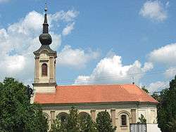 The Orthodox Church. | |
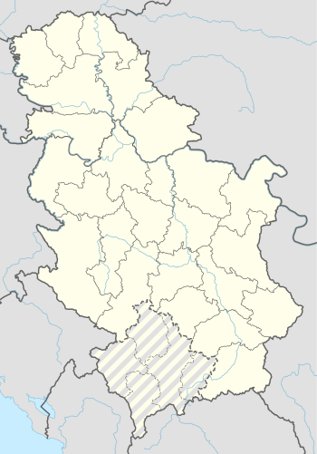 Ostojićevo Location of Ostojićevo within Serbia | |
| Coordinates: 45°53′17″N 20°10′00″E / 45.88806°N 20.16667°ECoordinates: 45°53′17″N 20°10′00″E / 45.88806°N 20.16667°E | |
| Country | Serbia |
| Province | Vojvodina |
| District | North Banat |
| Elevation | 88 m (289 ft) |
| Population (2011) | |
| • Ostojićevo | 2,844 |
| Time zone | UTC+1 (CET) |
| • Summer (DST) | UTC+2 (CEST) |
| Postal code | 23326 |
| Area code(s) | +381(0)23 |
| Car plates | KI |
Ostojićevo (Serbian Cyrillic: Остојићево) is a village in Serbia. It is situated in the Čoka municipality, North Banat District, Vojvodina province. The village has a Serb ethnic majority (56.15%) with a present Hungarian minority (26.51%) and its population numbering 2,844 people with about 300 Polish Silesian minority of Drogomyśl descent (2002 census).
Name
In Serbian the village is known as Ostojićevo (Остојићево), in Hungarian as Tiszaszentmiklós, in Slovak as Ostojičovo, in Croatian as Ostojićevo, and in German as Sankt Nikolaus an der Theiß.
Historical population
- 1961: 4,024
- 1971: 3,678
- 1981: 3,395
- 1991: 3,040
See also
References
- Slobodan Ćurčić, Broj stanovnika Vojvodine, Novi Sad, 1996.
Gallery
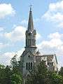 The Saint Joseph Catholic Church.
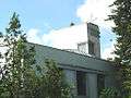 The Evangelical church.
| Wikimedia Commons has media related to Ostojićevo. |
This article is issued from
Wikipedia.
The text is licensed under Creative Commons - Attribution - Sharealike.
Additional terms may apply for the media files.