Đala
| Đala Ђала | |
|---|---|
| Village | |
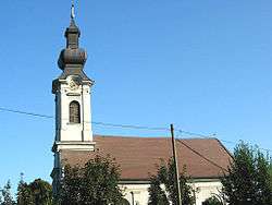 The Orthodox Church | |
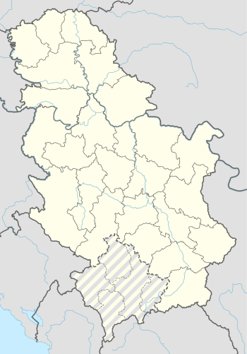 Đala Location of Đala within Serbia | |
| Coordinates: 46°09′00″N 20°06′00″E / 46.15000°N 20.10000°ECoordinates: 46°09′00″N 20°06′00″E / 46.15000°N 20.10000°E | |
| Country | Serbia |
| Province | Vojvodina |
| District | North Banat |
| Elevation | 76 m (249 ft) |
| Population (2002) | |
| • Đala | 1,004 |
| Time zone | UTC+1 (CET) |
| • Summer (DST) | UTC+2 (CEST) |
| Postal code | 23335 |
| Area code(s) | +381(0)24 |
| Car plates | KI |
Đala (Serbian Cyrillic: Ђала) is a village in Serbia. It is situated in the Novi Kneževac municipality, in the North Banat District, Vojvodina province. The village has a Serb ethnic majority (80.07%) with a present Hungarian (9.86%) and Romani minority (5.57%). It has a population of 1,004 people (2002 census). At the northern exit of the village is daytime border (7 AM - 7 PM) crossing with Hungary, Đala-Tiszasziget, which can be used only by citizens of Serbia, Hungary and other EU citizens, as well as citizens of Switzerland.
History
Bronze Age graves of south Russian steppe nomads were found in the village.
Population
- 1961: 1,723
- 1971: 1,578
- 1981: 1,325
- 1991: 1,072
See also
References
- Slobodan Ćurčić, Broj stanovnika Vojvodine, Novi Sad, 1996.
| Wikimedia Commons has media related to Đala. |
This article is issued from
Wikipedia.
The text is licensed under Creative Commons - Attribution - Sharealike.
Additional terms may apply for the media files.