Oshamambe Station
Oshamambe Station 長万部駅 | |
|---|---|
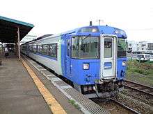
 Oshamambe Station in September 2002 | |
| Location |
228-7 Oshamambe, Oshamambe, Hokkaido Japan |
| Operated by |
|
| Line(s) | Hakodate Main Line, Muroran Main Line |
| Platforms | 2 island platforms |
| Tracks | 4 |
| Connections | Bus stop |
| Other information | |
| Station code | H47 |
| History | |
| Opened | 3 November 1903 |
| Location | |
 Oshamambe Station Location within Hokkaido  Oshamambe Station Oshamambe Station (Japan) | |
Oshamambe Station (長万部駅 Oshamanbe-eki) is a railway station in Oshamambe, Hokkaido, Japan, operated by Hokkaido Railway Company (JR Hokkaido).
Lines
Oshamambe Station is served by the Hakodate Main Line from Hakodate to Asahikawa and the Muroran Main Line to Iwamizawa.
The station is also planned to become a station of the Hokkaido Shinkansen between Shin-Yakumo and Kutchan that is scheduled to open in 2031. The first phase to Shin-Hakodate-Hokuto opened in 2016.
Station layout
The station consists of two ground-level island platforms serving four tracks.
Platforms
| 1 | ■ Hakodate Main Line | for Hakodate (Limited express services) |
| 2 | ■ Muroran Main Line | for Higashi-Muroran, Tomakomai and Sapporo (Limited express services) |
| 3/4 | ■ Hakodate Main Line | for Mori and Hakodate (Local services) |
| ■ Hakodate Main Line | for Kutchan and Otaru (Local services) | |
| ■ Muroran Main Line | for Higashi-Muroran, Tomakomai and Sapporo (Local services) |
Adjacent stations
| « | Service | » | ||
|---|---|---|---|---|
| Hakodate Main Line | ||||
| Nakanosawa | Local | Futamata | ||
| Muroran Main Line | ||||
| Terminus | Local | Shizukari | ||
Limited express services
- Super Hokuto (Sapporo - Hakodate)
- Cassiopeia (overnight sleeping car service between Ueno and Sapporo)
History
The station opened on 3 November 1903.[1] With the privatization of Japanese National Railways (JNR) on 1 April 1987, the station came under the control of JR Hokkaido.
Surrounding area
- National Route 5
- National Route 37
- Tokyo University of Science Oshamambe Campus
- Hokkaido Oshamambe High School
Bus services
- Hakodate Bus
- For Imagane and Setana
- For Yakumo, Mori, and Hakodate
- Niseko Bus
- For Kuromatsunai and Suttu
See also
References
- ↑ "Oshamambe Station information" (in Japanese). Japan: Hokkaido Railway Company. 2007. Retrieved 11 November 2011.
External links
| Wikimedia Commons has media related to Oshamambe Station. |
- Oshamambe Station information (in Japanese)
Stations of the Hokkaido Shinkansen | ||
|---|---|---|
| Planned | ||
Coordinates: 42°30′45″N 140°22′30″E / 42.51250°N 140.37500°E