Osceola, Wisconsin
| Osceola | |
|---|---|
| Village | |
 Location of Osceola in Polk County, Wisconsin. | |
 Osceola Location within the state of Wisconsin | |
| Coordinates: 45°19′21″N 92°41′55″W / 45.32250°N 92.69861°WCoordinates: 45°19′21″N 92°41′55″W / 45.32250°N 92.69861°W | |
| Country | United States |
| State | Wisconsin |
| County | Polk |
| Area[1] | |
| • Total | 4.32 sq mi (11.19 km2) |
| • Land | 4.19 sq mi (10.85 km2) |
| • Water | 0.13 sq mi (0.34 km2) |
| Population (2010)[2] | |
| • Total | 2,568 |
| • Estimate (2016)[3] | 2,517 |
| • Density | 612.9/sq mi (236.6/km2) |
| Time zone | UTC-6 (Central (CST)) |
| • Summer (DST) | UTC-5 (CDT) |
| ZIP codes | 54020 |
| Area code(s) | 715 & 534 |
| FIPS code | 55-60450 |
| Website | Official website |
Osceola is a village in Polk County, Wisconsin, United States. The population was 2,568 at the 2010 census. Located mostly within the Town of Osceola, the village sits on the border with Minnesota, separated by the St. Croix River.
History
The village was named after Osceola, chief of the Seminoles.[4]
Geography
Osceola is located at 45°19′20″N 92°41′54″W / 45.32222°N 92.69833°W (45.322365, -92.698534).[5] Cascade Falls, a 25-foot (7.6 m) waterfall with a 30-foot (9.1 m) crest on Osceola Creek, is located in downtown Osceola.
According to the United States Census Bureau, the village has a total area of 4.32 square miles (11.19 km2), of which, 4.19 square miles (10.85 km2) of it is land and 0.13 square miles (0.34 km2) is water.[1]
Demographics
| Historical population | |||
|---|---|---|---|
| Census | Pop. | %± | |
| 1880 | 311 | — | |
| 1890 | 384 | 23.5% | |
| 1900 | 466 | 21.4% | |
| 1910 | 634 | 36.1% | |
| 1920 | 674 | 6.3% | |
| 1930 | 607 | −9.9% | |
| 1940 | 642 | 5.8% | |
| 1950 | 700 | 9.0% | |
| 1960 | 942 | 34.6% | |
| 1970 | 1,152 | 22.3% | |
| 1980 | 1,581 | 37.2% | |
| 1990 | 2,075 | 31.2% | |
| 2000 | 2,421 | 16.7% | |
| 2010 | 2,568 | 6.1% | |
| Est. 2016 | 2,517 | [3] | −2.0% |
| U.S. Decennial Census[6] | |||
2010 census
As of the census[2] of 2010, there were 2,568 people, 1,142 households, and 660 families residing in the village. The population density was 612.9 inhabitants per square mile (236.6/km2). There were 1,289 housing units at an average density of 307.6 per square mile (118.8/km2). The racial makeup of the village was 96.0% White, 0.3% African American, 0.3% Native American, 1.0% Asian, 0.9% from other races, and 1.6% from two or more races. Hispanic or Latino of any race were 2.1% of the population.
There were 1,142 households of which 32.7% had children under the age of 18 living with them, 38.6% were married couples living together, 13.2% had a female householder with no husband present, 6.0% had a male householder with no wife present, and 42.2% were non-families. 36.0% of all households were made up of individuals and 11.5% had someone living alone who was 65 years of age or older. The average household size was 2.25 and the average family size was 2.91.
The median age in the village was 36.4 years. 26.1% of residents were under the age of 18; 7.1% were between the ages of 18 and 24; 27.4% were from 25 to 44; 26.6% were from 45 to 64; and 12.8% were 65 years of age or older. The gender makeup of the village was 47.3% male and 52.7% female.
2000 census
As of the census[7] of 2000, there were 2,421 people, 1,002 households, and 615 families residing in the village. The population density was 656.9 people per square mile (253.3/km²). There were 1,072 housing units at an average density of 290.9 per square mile (112.2/km²). The racial makeup of the village was 97.44% White, 0.37% Black or African American, 0.33% Native American, 0.21% Asian, 0.37% from other races, and 1.28% from two or more races. 0.91% of the population were Hispanic or Latino of any race.
There were 1,002 households out of which 35.5% had children under the age of 18 living with them, 44.9% were married couples living together, 12.0% had a female householder with no husband present, and 38.6% were non-families. 31.3% of all households were made up of individuals and 10.8% had someone living alone who was 65 years of age or older. The average household size was 2.38 and the average family size was 3.01.
In the village, the population was spread out with 27.9% under the age of 18, 9.8% from 18 to 24, 32.9% from 25 to 44, 16.7% from 45 to 64, and 12.7% who were 65 years of age or older. The median age was 33 years. For every 100 females, there were 92.4 males. For every 100 females age 18 and over, there were 88.2 males.
The median income for a household in the village was $39,000, and the median income for a family was $45,846. Males had a median income of $33,017 versus $22,453 for females. The per capita income for the village was $18,921. About 4.3% of families and 6.1% of the population were below the poverty line, including 7.2% of those under age 18 and 6.0% of those age 65 or over.
Education
Osceola is served by the Osceola School District. Osceola High School has grades 9-12.
Transportation
L.O. Simenstad Municipal Airport (KOEO), serves the city and surrounding communities. In 2006, a glider club was based there.
Museum
The Osceola and St Croix Valley Railway Museum is in Osceola, operating out of the historic 1916 Soo Line Depot. The railway moved to Osceola in 1992.
Notable people
- Henry Peleg Burdick, Wisconsin State Assemblyman
- Dougald D. Kennedy, Wisconsin State Assemblyman
- David E. Paulson, Wisconsin State Assemblyman
- Horst Rechelbacher, founder of the Aveda Corporation
- Gustav Stickley, architect and furniture designer
- Elmer Swenson, viticulturalist
References
- 1 2 "US Gazetteer files 2010". United States Census Bureau. Archived from the original on 2012-01-24. Retrieved 2012-11-18.
- 1 2 "American FactFinder". United States Census Bureau. Retrieved 2012-11-18.
- 1 2 "Population and Housing Unit Estimates". Retrieved June 9, 2017.
- ↑ Chicago and North Western Railway Company (1908). A History of the Origin of the Place Names Connected with the Chicago & North Western and Chicago, St. Paul, Minneapolis & Omaha Railways. p. 163.
- ↑ "US Gazetteer files: 2010, 2000, and 1990". United States Census Bureau. 2011-02-12. Retrieved 2011-04-23.
- ↑ "Census of Population and Housing". Census.gov. Retrieved June 4, 2015.
- ↑ "American FactFinder". United States Census Bureau. Retrieved 2008-01-31.
External links
- Osceola, Wisconsin village website
- Sanborn fire insurance map: 1911
Municipalities and communities of Polk County, Wisconsin, United States | ||
|---|---|---|
| Cities | 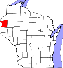 | |
| Villages | ||
| Towns | ||
| CDP | ||
| Unincorporated communities | ||
| Indian reservations | ||
| Footnotes | ‡This populated place also has portions in an adjacent county or counties | |