Osa, Norway
| Osa | |
|---|---|
| Village | |
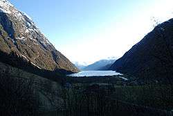 View of the village | |
 Osa Location in Hordaland county  Osa Osa (Norway) | |
| Coordinates: 60°35′20″N 07°02′07″E / 60.58889°N 7.03528°ECoordinates: 60°35′20″N 07°02′07″E / 60.58889°N 7.03528°E | |
| Country | Norway |
| Region | Western Norway |
| County | Hordaland |
| District | Hardanger |
| Municipality | Ulvik |
| Elevation[1] | 16 m (52 ft) |
| Time zone | UTC+01:00 (CET) |
| • Summer (DST) | UTC+02:00 (CEST) |
| Post Code | 5730 Ulvik |
Osa is a small village in the municipality of Ulvik in Hordaland county, Norway. The village lies at the end of the Osa Fjord, about 8 kilometres (5.0 mi) northeast of the village of Ulvik. The village sits at the confluence of the two rivers: Austdøla and Norddøla, which then join together for about 500 metres (1,600 ft) before emptying into the fjord. Historically, this place was the connection between the Hardanger district and Hallingskeid (up on the Hardangervidda plateau.[2]
References
- ↑ "Osa, Ulvik" (in Norwegian). yr.no. Retrieved 2014-05-25.
- ↑ Store norske leksikon. "Osafjorden" (in Norwegian). Retrieved 2014-05-25.
This article is issued from
Wikipedia.
The text is licensed under Creative Commons - Attribution - Sharealike.
Additional terms may apply for the media files.