Opal Cone
| Opal Cone | |
|---|---|
 | |
| Highest point | |
| Elevation | 1,736 m (5,696 ft) |
| Prominence | 86 m (282 ft) |
| Coordinates | 49°49′38.0″N 122°58′16.0″W / 49.827222°N 122.971111°WCoordinates: 49°49′38.0″N 122°58′16.0″W / 49.827222°N 122.971111°W |
| Geography | |
| Location | Garibaldi Park, British Columbia, Canada |
| Parent range | Garibaldi Ranges |
| Topo map | NTS 92.G/15 |
| Geology | |
| Age of rock | Holocene |
| Mountain type | Cinder cone |
| Volcanic arc/belt | Canadian Cascade ArcGaribaldi Volcanic Belt |
| Last eruption | 9300 BP |
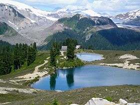
Opal Cone is a cinder cone located on the southeast flank of Mount Garibaldi in the Coast Mountains of British Columbia, Canada. It is the source of a 15 km long broad dacite lava flow with prominent wrinkled ridges. The lava flow is unusually long for a silicic lava flow.
Opal Cone is a member of the Cascade Volcanoes, but it is located in the Garibaldi Ranges in the Coast Mountains and not in the Cascade Range proper.
See also
External links
- Opal Cone in the Canadian Mountain Encyclopedia
- Hiking Opal Cone - Online guide for hiking to the summit
References
This article is issued from
Wikipedia.
The text is licensed under Creative Commons - Attribution - Sharealike.
Additional terms may apply for the media files.