Ogilvie Aerodrome
| Ogilvie Aerodrome | |||||||||||
|---|---|---|---|---|---|---|---|---|---|---|---|
| Summary | |||||||||||
| Airport type | Public | ||||||||||
| Operator | Government of Yukon | ||||||||||
| Location | Ogilvie River, Yukon | ||||||||||
| Time zone | PST (UTC−08:00) | ||||||||||
| • Summer (DST) | PDT (UTC−07:00) | ||||||||||
| Elevation AMSL | 1,640 ft / 500 m | ||||||||||
| Coordinates | 65°40′28″N 138°06′56″W / 65.67444°N 138.11556°WCoordinates: 65°40′28″N 138°06′56″W / 65.67444°N 138.11556°W | ||||||||||
| Map | |||||||||||
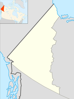 CFS4 Location in Yukon | |||||||||||
| Runways | |||||||||||
| |||||||||||
|
Source: Canada Flight Supplement[1] | |||||||||||
Ogilvie Aerodrome formerly Ogilvie River Aerodrome (IATA: FS4, TC LID: CFS4) is a registered aerodrome located near Ogilvie River in the Yukon, Canada and has a 50 ft (15 m) wide runway that receives no maintenance.
During the late-1960s to early-1970s the Canadian Forces used this strip as a place to offload equipment and supplies in the construction of the steel bridge over the Oglive River which was carried out by 3 Field Squadron Canadian Engineers stationed at CFB Chilliwack in British Columbia.
References
- ↑ Canada Flight Supplement. Effective 0901Z 19 July 2018 to 0901Z 13 September 2018.
| By name | |
|---|---|
| By location indicator | |
| By province/territory | |
| By area | |
| National Airports System | |
| Related | |
| |
This article is issued from
Wikipedia.
The text is licensed under Creative Commons - Attribution - Sharealike.
Additional terms may apply for the media files.