Obi, Nasarawa State
Coordinates: 8°22′N 8°46′E / 8.367°N 8.767°E
| Obi, Nasarawa State Alago | |
|---|---|
| LGA | |
 Obi, Nasarawa State | |
| Coordinates: 8°22′N 8°46′E / 8.367°N 8.767°E | |
| Country |
|
| State | Nasarawa State |
| Headquarters | Obi |
| Government | |
| • Osuko | Osuko |
| Time zone | UTC+1 (WAT) |
Obi is a Local Government Area in Nasarawa State, Nigeria. Its headquarters are in the town of Obi.
It has an area of 967 km² and a population of 148,874 at the 2006 census.
The postal code of the area is 951.[1]
References
- ↑ "Post Offices- with map of LGA". NIPOST. Archived from the original on October 7, 2009. Retrieved 2009-10-20.
State capital: Lafia | ||
| Local Government Areas | 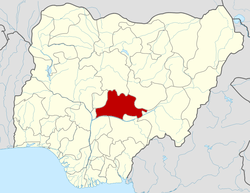 | |
(THE KING'S TITLE)THE NAME OF ITS FIRST KING IS CALLED OSUKO OMAME (Agriculture)Food basket of Nasarawa State
This article is issued from
Wikipedia.
The text is licensed under Creative Commons - Attribution - Sharealike.
Additional terms may apply for the media files.