Oberon, New South Wales
| Oberon New South Wales | |||||||||
|---|---|---|---|---|---|---|---|---|---|
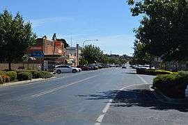 Oberon Street, the main street of Oberon | |||||||||
|
Oberon | |||||||||
| Coordinates | 33°43′S 149°52′E / 33.717°S 149.867°ECoordinates: 33°43′S 149°52′E / 33.717°S 149.867°E | ||||||||
| Population | 2,459 (2011 census)[1] | ||||||||
| Postcode(s) | 2787 | ||||||||
| Elevation | 1,113 m (3,652 ft) | ||||||||
| LGA(s) | Oberon Shire | ||||||||
| County | Westmoreland | ||||||||
| State electorate(s) | Bathurst | ||||||||
| Federal Division(s) | Calare | ||||||||
| |||||||||
Oberon is a town located within the Oberon Shire local government area, in the central tablelands region of New South Wales, Australia. The main industries are farming, forestry and wood products. The town usually receives snowfall during the winter months, owing to its high elevation. At the 2011 census, Oberon had a population of 2,459 people.[1]
It is the birthplace of Greens politician Bob Brown, Ken Sutcliffe, supermotard rider Scott Saul and former Penrith Panthers player Mark Booth. Oberon is located near Jenolan Caves and the Kanangra-Boyd National Park.
History
The Fish River Creek Post Office opened on 1 January 1855 and was renamed Oberon in 1866.[2]
Heritage listings
Oberon has a number of heritage-listed sites, including:
- Blue Mountains National Park: Blue Mountains walking tracks[3]
- 124 Oberon Street: Malachi Gilmore Memorial Hall[4]
- Tarana-Oberon railway: Oberon railway station[5]
- Caves Road: Jenolan Caves[6]
Commercial area
Oberon's main streets are Carrington Avenue-Oberon Street and Ross Street. The town has several parks and sports facilities. Such parks include the Oberon Showground,Cunynghame Oval, Apex Park and The Hillary Camwich Memorial park. Oberon also has a museum on North Street. Oberon has a caravan park on Cunynghame Street off North Street, a hospital on North Street, a camping ground adjacent to the caravan park and a wood gallery on Oberon Street. Rotarys Lookout is located on Abercrombie Road and to the east of the town is the Blenheim State Forest which includes walking tracks.
Culture
Fishing is a pastime possible at Lake Oberon and The Reef Reserve. Oberon also has a golf club off Hume Street.
Oberon is known for its two inns, the Big Trout Motor Inn and the Highlands Motor Inn.
South of the town is Lake Oberon, Oberon Dam and the Fish River. There is a picnic area at the dam and a reserve with walking tracks near the lake.
Rugby league football coach Craig Bellamy started his playing career with Oberon's team in the 1970s.[7]
Mayfield Garden is a popular botanical garden that covers 16 hectares (40 acres) of land. It is open daily, except on public holidays and there is an entry fee.
Transport
From 1923 to 1979, Oberon was served by a branch railway line noted for its very steep 4% gradients and very sharp 100 m radius curves.[8] Following closure, that line was allowed to fall into disrepair, but has been under restoration by the volunteer organisation Oberon Tarana Heritage Railway since 2005.[9]
Access
- From Bathurst it is around 49 km south, along the sealed O'Connell Road.
- From Great Western Highway near Hartley it's around 50 km south-west, along the sealed Jenolan Caves and Duckmaloi Roads.
- From Goulburn it's around 140 km north, along the sealed Goulburn-Oberon Road.
- Relief maps of the area - Provided by NSW Central Ranges Weather - see link below.
Climate
Oberon has a subalpine climate (Cwc); subtropical highland influenced (Cwb) oceanic climate (Cfb) with mild to warm summers, cool to cold winters averaging 0 to 9°C and evenly spread rainfall throughout the year. Frosts occur regularly during autumn, winter and spring. Because of its elevation, several snowfalls can be expected each year during winter. On an annual basis, Oberon receives 80.8 clear days.
| Climate data for Oberon, NSW (Springbank); 1,053 m AMSL; 33° 40' 5.52" S | |||||||||||||
|---|---|---|---|---|---|---|---|---|---|---|---|---|---|
| Month | Jan | Feb | Mar | Apr | May | Jun | Jul | Aug | Sep | Oct | Nov | Dec | Year |
| Record high °C (°F) | 36.0 (96.8) |
34.5 (94.1) |
32.6 (90.7) |
25.0 (77) |
23.1 (73.6) |
17.1 (62.8) |
16.8 (62.2) |
20.2 (68.4) |
25.6 (78.1) |
30.1 (86.2) |
35.2 (95.4) |
35.0 (95) |
36.0 (96.8) |
| Average high °C (°F) | 24.8 (76.6) |
23.7 (74.7) |
21.5 (70.7) |
17.1 (62.8) |
13.1 (55.6) |
9.4 (48.9) |
8.7 (47.7) |
10.3 (50.5) |
13.7 (56.7) |
17.0 (62.6) |
19.8 (67.6) |
23.2 (73.8) |
16.8 (62.2) |
| Average low °C (°F) | 10.8 (51.4) |
11.2 (52.2) |
8.9 (48) |
5.3 (41.5) |
2.5 (36.5) |
0.8 (33.4) |
−0.4 (31.3) |
0.3 (32.5) |
2.3 (36.1) |
4.8 (40.6) |
6.7 (44.1) |
8.9 (48) |
5.2 (41.4) |
| Record low °C (°F) | −0.5 (31.1) |
1.7 (35.1) |
−2.2 (28) |
−4.0 (24.8) |
−6.3 (20.7) |
−8.5 (16.7) |
−9.0 (15.8) |
−7.2 (19) |
−5.8 (21.6) |
−2.8 (27) |
−2.5 (27.5) |
−3.0 (26.6) |
−9.0 (15.8) |
| Average precipitation mm (inches) | 80.6 (3.173) |
61.3 (2.413) |
66.1 (2.602) |
57.4 (2.26) |
60.6 (2.386) |
79.2 (3.118) |
70.8 (2.787) |
75.5 (2.972) |
67.4 (2.654) |
78.4 (3.087) |
71.4 (2.811) |
73.8 (2.906) |
842.9 (33.185) |
| Average precipitation days | 7.8 | 7.5 | 7.8 | 7.5 | 8.7 | 11.4 | 10.7 | 10.5 | 9.2 | 9.4 | 8.0 | 7.5 | 106.0 |
| Source: [10] | |||||||||||||
See also
References
- 1 2 Australian Bureau of Statistics (31 October 2012). "Oberon (Urban Centre/Locality)". 2011 Census QuickStats. Retrieved 22 March 2013.

- ↑ Premier Postal History. "Post Office List". Premier Postal Auctions. Retrieved 2011-05-26.
- ↑ "Blue Mountains Walking tracks, New South Wales State Heritage Register (NSW SHR) Number H00980". New South Wales State Heritage Register. Office of Environment and Heritage. Retrieved 18 May 2018.
- ↑ "Malachi Gilmore Memorial Hall, New South Wales State Heritage Register (NSW SHR) Number H01680". New South Wales State Heritage Register. Office of Environment and Heritage. Retrieved 18 May 2018.
- ↑ "Oberon Railway Station group, New South Wales State Heritage Register (NSW SHR) Number H01215". New South Wales State Heritage Register. Office of Environment and Heritage. Retrieved 18 May 2018.
- ↑ "Jenolan Caves Reserve, New South Wales State Heritage Register (NSW SHR) Number H01698". New South Wales State Heritage Register. Office of Environment and Heritage. Retrieved 18 May 2018.
- ↑ Alan Whiticker. "Craig Bellamy". rugbyleagueproject.org. Shawn Dollin, Andrew Ferguson and Bill Bates. Retrieved 31 August 2014.
- ↑ "Oberon Branch". nswrail.net. Rolfe Bozier. Retrieved 25 July 2014.
- ↑ Oberon Tarana Heritage Railway. Retrieved 22 March 2013.
- ↑ Climate statistics for Australian locations: Oberon (Springbank). Bureau of Meteorology. Retrieved 13 April 2013.
External links
![]()