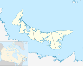
O'Leary, Prince Edward Island
| Town of O’Leary | ||
|---|---|---|
| Town | ||
| ||
| Nickname(s): Hockeytown | ||
 Location of O'Leary in Prince Edward Island | ||
| Coordinates: 46°42′25″N 64°13′50″W / 46.70694°N 64.23056°W | ||
| Country | Canada | |
| Province | Prince Edward Island | |
| County | Prince County | |
| Parish | Halifax | |
| Government | ||
| • Type | Town Council | |
| • Mayor | Eric Gavin | |
| • Deputy Mayor | Carol Ferguson | |
| • Administrator | Beverley Shaw | |
| • Councilors |
Blake Adams Joey Dumville Marvin MacDonald Darren MacKinnon Tashia Maynard | |
| Area | ||
| • Total | 4.4 km2 (1.68 sq mi) | |
| Elevation | 31 m (102 ft) | |
| Population (2016) | ||
| • Total | 815 | |
| • Density | 190/km2 (490/sq mi) | |
| Canadian Postal code | C0B 1V0 | |
| Area code(s) | 902 | |
| Telephone Exchange | 726 807 859 | |
| NTS Map | 021I09 | |
| GNBC Code | BABYS | |
| Website | http://www.townofoleary.com/index.php | |
O'Leary is a town located in Prince County, Prince Edward Island.[1]
Economy
The community's economy is tied to the potato farming industry and is home to the Canadian Potato Museum.
Climate
| Climate data for O'Leary | |||||||||||||
|---|---|---|---|---|---|---|---|---|---|---|---|---|---|
| Month | Jan | Feb | Mar | Apr | May | Jun | Jul | Aug | Sep | Oct | Nov | Dec | Year |
| Record high °C (°F) | 13.5 (56.3) |
13 (55) |
16.5 (61.7) |
21.5 (70.7) |
32.2 (90) |
33.5 (92.3) |
32.8 (91) |
32.5 (90.5) |
32.5 (90.5) |
24 (75) |
20 (68) |
13.9 (57) |
33.5 (92.3) |
| Average high °C (°F) | −4.4 (24.1) |
−3.8 (25.2) |
0.7 (33.3) |
6.5 (43.7) |
14.3 (57.7) |
19.8 (67.6) |
23.2 (73.8) |
22.8 (73) |
18 (64) |
11.4 (52.5) |
5.1 (41.2) |
−1.2 (29.8) |
9.4 (48.9) |
| Average low °C (°F) | −12.7 (9.1) |
−12.2 (10) |
−7 (19) |
−1.2 (29.8) |
4.3 (39.7) |
9.8 (49.6) |
13.8 (56.8) |
13.6 (56.5) |
9.5 (49.1) |
4.1 (39.4) |
−0.9 (30.4) |
−7.9 (17.8) |
1.1 (34) |
| Record low °C (°F) | −31 (−24) |
−29.4 (−20.9) |
−25.6 (−14.1) |
−13.9 (7) |
−6.1 (21) |
−1.1 (30) |
3.9 (39) |
3.3 (37.9) |
−1.1 (30) |
−6.7 (19.9) |
−15 (5) |
−27.2 (−17) |
−31 (−24) |
| Average precipitation mm (inches) | 97.1 (3.823) |
78.3 (3.083) |
89.4 (3.52) |
85.2 (3.354) |
95.6 (3.764) |
82.6 (3.252) |
100.1 (3.941) |
84.9 (3.343) |
99.7 (3.925) |
107.9 (4.248) |
110.2 (4.339) |
109.7 (4.319) |
1,140.7 (44.909) |
| Source: Environment Canada[2] | |||||||||||||
References
- ↑ "Municipal Affairs and Provincial Planning". Department of Finance, Energy and Municipal Affairs. Retrieved 21 July 2013.
- ↑ Environment Canada Canadian Climate Normals 1971–2000, accessed 15 July 2009
Coordinates: 46°42′25″N 64°13′50″W / 46.70694°N 64.23056°W
This article is issued from
Wikipedia.
The text is licensed under Creative Commons - Attribution - Sharealike.
Additional terms may apply for the media files.
