Nutakki
| Nutakki | |
|---|---|
| Village | |
 Directional signboard of Nutakki village | |
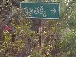
 Nutakki Location in Andhra Pradesh, India  Nutakki Nutakki (India) | |
| Coordinates: 16°24′50″N 80°39′2″E / 16.41389°N 80.65056°ECoordinates: 16°24′50″N 80°39′2″E / 16.41389°N 80.65056°E | |
| Country | India |
| State | Andhra Pradesh |
| District | Guntur |
| Government | |
| • Type | Panchayati raj |
| • Body | Nutakki Gram Panchayat |
| • Sarpanch | Kothapalli Koteswaramma |
| Area[1] | |
| • Total | 11.22 km2 (4.33 sq mi) |
| Population (2011)[1] | |
| • Total | 9,236 |
| • Density | 820/km2 (2,100/sq mi) |
| Languages | |
| • Official | Telugu |
| Time zone | UTC+5:30 (IST) |
| PIN | 522303 |
| Telephone code | 08645 |
| Vehicle registration | AP |
| Lok Sabha | Guntur |
| Assembly constituency | Mangalagiri |
Nutakki is a village in Guntur district of the Indian state of Andhra Pradesh. It is located in Mangalagiri mandal of Guntur revenue division.[1]
Geography
Nutakki lies on the southside of River Krishna and about 12 kilometres (7.5 mi) southeast from Vijayawada.
Government and politics
Nutakki gram panchayat is the local self-government of the village.[2] The panchayat is divided into 14 wards and each ward is represented by a ward member.[3] The ward members are headed by a Sarpanch.[4][5] CH Komala is the secretary of the panchayat.[6]
References
- 1 2 3 "District Census Handbook - Guntur" (PDF). Census of India. p. 14,270. Retrieved 18 January 2015.
- ↑ "Nutakki Village Panchayat". National Panchayat Portal. Retrieved 6 May 2016.
- ↑ "Local Body Elected Members of Nutakki". Area Profiler. National Informatics Centre. Retrieved 5 June 2016.
- ↑ Social Science. Vk Publications. p. 117. ISBN 9788179732144.
- ↑ "List of elected Sarpanchas in Grampanchayat of Guntur district, 2013" (PDF). State Election Commission. Retrieved 5 June 2016.
- ↑ "Elected Representatives". National Panchayat Portal. Retrieved 6 May 2016.
This article is issued from
Wikipedia.
The text is licensed under Creative Commons - Attribution - Sharealike.
Additional terms may apply for the media files.