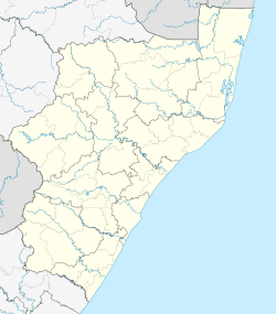
Nquthu
| Nquthu | |
|---|---|
 Nquthu  Nquthu Nquthu (South Africa)  Nquthu Nquthu (Africa) | |
| Coordinates: 28°13′55″S 30°33′58″E / 28.232°S 30.566°ECoordinates: 28°13′55″S 30°33′58″E / 28.232°S 30.566°E | |
| Country | South Africa |
| Province | KwaZulu-Natal |
| District | Umzinyathi |
| Municipality | Nqutu |
| Area[1] | |
| • Total | 5.31 km2 (2.05 sq mi) |
| Population (2011)[1] | |
| • Total | 5,453 |
| • Density | 1,000/km2 (2,700/sq mi) |
| Racial makeup (2011)[1] | |
| • Black African | 97.9% |
| • Coloured | 0.3% |
| • Indian/Asian | 0.2% |
| • White | 0.2% |
| • Other | 1.4% |
| First languages (2011)[1] | |
| • Zulu | 91.5% |
| • Sotho | 1.6% |
| • English | 1.6% |
| • Other | 5.2% |
| Time zone | UTC+2 (SAST) |
Nquthu is a town in Umzinyathi District Municipality in the KwaZulu-Natal province of South Africa.
Village 24 km west-south-west of Barklieside and 53 km east of Dundee, KwaZulu-Natal. Of Zulu origin, the name is derived from isquthu, ‘flat-topped vessel’, descriptive of a nearby hill from which the village takes its name.[2]
Education
Primary
- Monte Casino Primary
Secondary
- Sihayo High School
 A picture of children from Sihayo.
 - Mgazi High School
- Ekucabangeni Secondary School
References
- 1 2 3 4 "Main Place Nquthu". Census 2011.
- ↑ "Dictionary of Southern African Place Names (Public Domain)". Human Science Research Council. p. 341.
This article is issued from
Wikipedia.
The text is licensed under Creative Commons - Attribution - Sharealike.
Additional terms may apply for the media files.
.svg.png)