Northwest Regional Airport Terrace-Kitimat
| Northwest Regional Airport Terrace-Kitimat Terrace Airport | |||||||||||||||
|---|---|---|---|---|---|---|---|---|---|---|---|---|---|---|---|
 | |||||||||||||||
| Summary | |||||||||||||||
| Airport type | Public | ||||||||||||||
| Owner/Operator | Terrace-Kitimat Airport Society | ||||||||||||||
| Serves | Terrace, Kitimat, Gitlaxt'aamiks, Hazelton | ||||||||||||||
| Location | Terrace, British Columbia | ||||||||||||||
| Time zone | PST (UTC−08:00) | ||||||||||||||
| • Summer (DST) | PDT (UTC−07:00) | ||||||||||||||
| Elevation AMSL | 713 ft / 217 m | ||||||||||||||
| Coordinates | 54°28′07″N 128°34′42″W / 54.46861°N 128.57833°WCoordinates: 54°28′07″N 128°34′42″W / 54.46861°N 128.57833°W | ||||||||||||||
| Website | http://www.yxt.ca | ||||||||||||||
| Map | |||||||||||||||
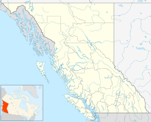
 CYXT Location in British Columbia  CYXT CYXT (Canada) | |||||||||||||||
| Runways | |||||||||||||||
| |||||||||||||||
| Statistics (2014) | |||||||||||||||
| |||||||||||||||
Northwest Regional Airport Terrace-Kitimat (IATA: YXT, ICAO: CYXT), is located 3 nautical miles (5.6 km; 3.5 mi) south of Terrace, British Columbia, Canada.[1] The airport also serves Kitimat, 56 km (35 mi) to the south, and the Nass Valley. The airport is owned and operated by the Terrace-Kitimat Airport Society.
Airlines
| Airlines | Destinations |
|---|---|
| Air Canada Express | Vancouver |
| Central Mountain Air | Dease Lake, Prince George, Smithers |
| WestJet Encore | Calgary, Vancouver |
Statistics
Annual traffic
| Year | Aircraft movements | % change |
|---|---|---|
| 2010 | 12,461 | |
| 2011 | 15,220 | |
| 2012 | 16,161 | |
| 2013 | 20,852 | |
| 2014 | 20,079 |
References
- 1 2 Canada Flight Supplement. Effective 0901Z 19 July 2018 to 0901Z 13 September 2018.
- ↑ Synoptic/Metstat Station Information
- 1 2 "Aircraft Movement Statistics: NAV CANADA Towers and Flight Service Stations: Annual Report (TP 577) – 20" (PDF). Retrieved April 25, 2018.
External links
| Wikimedia Commons has media related to Northwest Regional Airport (British Columbia). |
- Northwest Regional Airport Terrace-Kitimat (official website)
- Past three hours METARs, SPECI and current TAFs for Terrace Airport from Nav Canada as available.
This article is issued from
Wikipedia.
The text is licensed under Creative Commons - Attribution - Sharealike.
Additional terms may apply for the media files.