Dease Lake Airport
| Dease Lake Airport | |||||||||||
|---|---|---|---|---|---|---|---|---|---|---|---|
| Summary | |||||||||||
| Airport type | Public | ||||||||||
| Operator | Stikine Airport Society | ||||||||||
| Location | Dease Lake, British Columbia | ||||||||||
| Time zone | PST (UTC−08:00) | ||||||||||
| • Summer (DST) | PDT (UTC−07:00) | ||||||||||
| Elevation AMSL | 2,634 ft / 803 m | ||||||||||
| Coordinates | 58°25′20″N 130°01′53″W / 58.42222°N 130.03139°WCoordinates: 58°25′20″N 130°01′53″W / 58.42222°N 130.03139°W | ||||||||||
| Map | |||||||||||
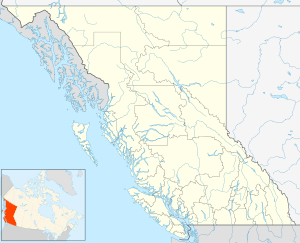
 CYDL Location in British Columbia | |||||||||||
| Runways | |||||||||||
| |||||||||||
|
Source: Canada Flight Supplement[1] | |||||||||||
Dease Lake Airport, (IATA: YDL, ICAO: CYDL), is located 1.5 nautical miles (2.8 km; 1.7 mi) south of Dease Lake, British Columbia, Canada.
Airlines
| Airlines | Destinations |
|---|---|
| Central Mountain Air | Charter: Smithers, Prince George |
References
- ↑ Canada Flight Supplement. Effective 0901Z 19 July 2018 to 0901Z 13 September 2018.
External links
- Page about this airport on COPA's Places to Fly airport directory
- Past three hours METARs, SPECI and current TAFs for Dease Lake Airport from Nav Canada as available.
- More Info on Dease Lake Airport
This article is issued from
Wikipedia.
The text is licensed under Creative Commons - Attribution - Sharealike.
Additional terms may apply for the media files.