North Pass
| North Pass | |
|---|---|
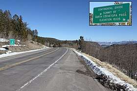 Looking east from the top of the pass. The inset shows the sign on the south side of the pass. | |
| Elevation | 10,010 ft (3,051 m)[1] |
| Traversed by | State Highway 114 |
| Location | Saguache County, Colorado, U.S. |
| Range | Cochetopa Hills |
| Coordinates | 38°13′00″N 106°34′32″W / 38.21667°N 106.57556°WCoordinates: 38°13′00″N 106°34′32″W / 38.21667°N 106.57556°W[1] |
| Topo map | USGS North Pass[2] |
North Pass (elevation: 10,010 ft (3,050 m))[1] is a mountain pass over the Continental Divide in Saguache County, Colorado. The pass is traversed by Colorado State Highway 114 between Saguache to the southeast and Gunnison to the northwest.[2] The route is an all-weather paved road.
References
This article is issued from
Wikipedia.
The text is licensed under Creative Commons - Attribution - Sharealike.
Additional terms may apply for the media files.