Norfolk Wildlife Trust
|
| |
| Formation | 1926 |
|---|---|
| Headquarters | Bewick House |
Membership | 35,000 |
| Website | Norfolk Wildlife Trust website |
The Norfolk Wildlife Trust, formerly known as the Norfolk Naturalists' Trust, is one of almost 50 wildlife trusts throughout the United Kingdom managing sites in the English county of Norfolk. Founded in 1926, it is the oldest of all the trusts having over 35,000 members and over 1,000 volunteers.[1] It manages 32 nature reserves.
Key
Public access
Other classifications
|
|
Sites
| Site | Photograph | Area[lower-alpha 1] | Location[lower-alpha 1] | Public access | Classifications | Description |
|---|---|---|---|---|---|---|
| Alderfen Broad[2] | 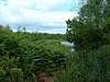 |
20 hectares (49 acres) |
Norwich 52°43′26″N 1°28′59″E / 52.724°N 1.483°E TG 353 197 |
YES | Ramsar,[3] SAC,[4] SPA,[5] SSSI[6] | This area of fenland peat has open water, carr woodland and reedswamp. Breeding birds include the great crested grebe, water rail, grasshopper warbler and reed warbler.[7] |
| Barton Broad[8] | 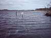 |
164 hectares (410 acres) |
Norwich 52°43′59″N 1°28′44″E / 52.733°N 1.479°E TG 350 207 |
YES | NCR,[9] NNR,[10] Ramsar,[3] SAC,[4] SPA[5] SSSI[11] | The Broad was created in the Middle Ages by digging for peat and the River Ant was later diverted through it, which allowed navigation. It has diverse aquatic plants and fish, and the surrounding fens have nationally rare plants and invertebrates.[8] |
| Booton Common[12] | 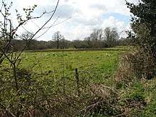 |
8 hectares (20 acres) |
Norwich 52°45′43″N 1°07′37″E / 52.762°N 1.127°E TG 111 228 |
YES | SAC,[13] SSSI[14] | The common has diverse habitats, including wet calcareous fen grassland, acid heath, tall fen, alder woodland and a stream. Wet hollows are floristically rich and there are a variety of breeding birds.[15] |
| Cley Marshes[16] | 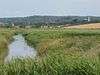 |
160 hectares (400 acres) |
Holt 52°57′14″N 1°03′22″E / 52.954°N 1.056°E TG 054 440 |
FEE | AONB,[17] GCR,[18] NCR,[19] Ramsar,[20] SAC,[21] SPA,[22] SSSI[23] | This is the NWT's oldest reserve, purchased in 1926 as a bird sanctuary. It has saline lagoons, a shingle beach, grazing marshes and reedbeds, which support many wintering and migrating wildfowl and waders.[16] |
| Cockshoot Broad[24] | 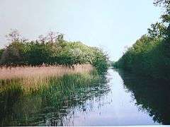 |
5 hectares (12 acres) |
Norwich 52°41′42″N 1°27′58″E / 52.695°N 1.466°E TG 343 165 |
YES | NCR,[25] NNR[26] Ramsar,[3] SAC,[4] SPA[5] SSSI[27] | The water quality of this broad is very high and it has large beds of water lilies, which provide a habitat for many insects, including red eyed and variable damselflies.[24] |
| East Winch Common[28] | 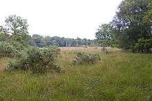 |
31 hectares (77 acres) |
King's Lynn 52°42′58″N 0°30′43″E / 52.716°N 0.512°E TF 698 161 |
YES | SSSI[29] | This site is mainly wet acid heath on peat, and it is dominated by heather and cross-leaved heath. There are many wet hollows, which have diverse fen and mire flora, and areas of young woodland.[30] |
| East Wretham Heath[31] | 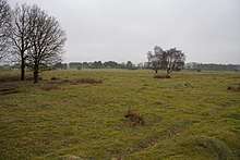 |
143 hectares (350 acres) |
Thetford 52°27′47″N 0°48′50″E / 52.463°N 0.814°E TL 913 887 |
YES | NCR,[32] SAC,[33] SPA,[34] SSSI[35] | The principal ecological interest of this site lies in areas of Breckland grassland and two meres, which are supplied by ground water, and fluctuate irregularly. These conditions have led to unusual plants communities which are tolerant of alternate wetting and drying, such as reed canary grass and amphibious bistort.[36] |
| Foxley Wood[37] | 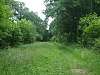 |
123 hectares (300 acres) |
Dereham 52°45′54″N 1°02′10″E / 52.765°N 1.036°E TG 049 229 |
YES | NCR,[38] NNR,[39] SSSI[40] | This is the largest area of ancient woodland in the county. The flora is diverse, with more than 250 species recorded, and invertebrates include several rare butterflies, such as the purple emperor and white admiral.[41] |
| Hethel Old Thorn [42] | 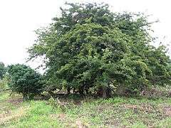 |
0.025 hectares (0.062 acres) |
Norwich 52°33′32″N 1°12′04″E / 52.559°N 1.201°E TG 171 005 |
YES | This is the smallest wildlife trust nature reserve in Britain, consisting of one ancient hawthorn tree, which may date to the thirteenth century. In 1755 its girth was recorded as 9 feet 1 inch, and it has now decayed to a much smaller size, but it is still healthy.[42] | |
| Hickling Broad[43] |  |
600 hectares (1,500 acres) |
Norwich 52°44′35″N 1°35′46″E / 52.743°N 1.596°E TG 428 222 |
FEE | AONB,[17] GCR,[18] NCR,[44] NNR,[45] Ramsar,[3] SAC,[4] SPA,[5] SSSI[46] | This is the largest of The Broads, and it has large breeding populations of waterbirds. Rare insects include the swallowtail butterfly and Norfolk hawker dragonfly, and there are mammals such as red deer and Chinese water deer.[43] |
| Hoe Rough[47] |  |
12 hectares (30 acres) |
Dereham 52°42′47″N 0°55′37″E / 52.713°N 0.927°E TF 978 168 |
YES | SSSI[48] | This is mixture of grassland and wet fen. Around 200 species of invertebrates have been recorded, including the rare great crested newt. Notable plants include green-winged and early marsh orchids.[47] |
| Holme Dunes [49] | 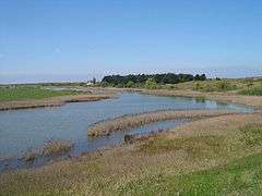 |
192 hectares (470 acres) |
Hunstanton 52°58′26″N 0°33′04″E / 52.974°N 0.551°E TF 714 449 |
FEE | AONB,[17] GCR,[18] NCR,[19] NNR,[50] Ramsar,[20] SAC,[21] SPA,[22] SSSI[23] | This site provides a refuge for many migrating birds such as wheatears, wrynecks, yellow-browed warblers and barred warblers. Other fauna include natterjack toads, butterflies and dragonflies.[49] |
| Honeypot Wood [51] | 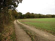 |
10 hectares (25 acres) |
Dereham 52°41′31″N 0°51′36″E / 52.692°N 0.860°E TF 934 143 |
YES | SSSI[52] | This is an ancient coppiced wood on calcareous soil. It has a rich ground layer, which is dominated by dog's mercury, and other flora include greater butterfly-orchid and broad-leaved helleborine. A total of 208 plant species have been recorded.[53] |
| Lolly Moor [54] |  |
3 hectares (7.4 acres) |
Dereham 52°39′14″N 0°56′38″E / 52.654°N 0.944°E TF 992 103 |
YES | This site has wet grassland, scrub and alder carr. Flora include cowslip, lesser celandine, southern marsh orchid, marsh helleborine and twayblade.[54] | |
| Lower Wood, Ashwellthorpe[55] |  |
37 hectares (91 acres) |
Norwich 52°32′10″N 1°09′29″E / 52.536°N 1.158°E TM 143 978 |
YES | SSSI[56] | This ancient wood on chalky boulder clay has a diverse ground flora with uncommon species such as wood spurge, early-purple orchid, common twayblade, ramsons, water avens and woodruff.[57] |
| Martham Broad[58] | 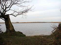 |
60 hectares (150 acres) |
Great Yarmouth 52°43′26″N 1°39′00″E / 52.724°N 1.650°E TG 466 203 |
YES | NNR,[59] Ramsar,[3] SAC,[4] SPA,[5] SSSI[46] | This reserve is composed of two shallow broads divided by the River Thurne, together with fen, reedbeds and marshes. There are a number of bat species and breeding birds include bearded tits, common terns, Cetti's warblers and marsh harriers.[58] |
| Narborough Railway Line[60] | 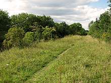 |
8 hectares (20 acres) |
King's Lynn 52°40′34″N 0°35′13″E / 52.676°N 0.587°E TF 750 118 |
PL | SSSI[61] | This nineteenth-century embankment is probably the most ecologically diverse chalk grassland site in the county, with many flowering plants which attract a wide range of butterflies. There is also a variety of mosses and molluscs.[62] |
| New Buckenham Common[63] | 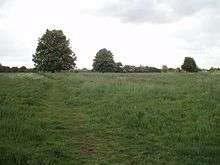 |
37 hectares (91 acres) |
Norwich 52°28′19″N 1°04′34″E / 52.472°N 1.076°E TM 090 905 |
YES | SSSI[64] | This unimproved grassland is traditionally managed by grazing. It has the largest colony of green-winged orchids in the county, and there are a stream and pool which have aquatic plants.[65] |
| Pigneys Wood [66] | 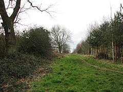 |
23.5 hectares (58 acres) |
North Walsham 52°50′13″N 1°24′25″E / 52.837°N 1.407°E TG 296 321 |
YES | LNR[67] | This wood has 40 different species of trees, most of which have been planted since 1993, but there is a 450 year old oak. There is also a range of birds, butterflies and dragonflies. Mammals include otters, water voles and badgers.[66] |
| Ranworth Broad[68] | 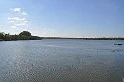 |
136 hectares (340 acres) |
Norwich 52°40′55″N 1°29′13″E / 52.682°N 1.487°E TG 358 151 |
YES | NCR,[25] NNR [26] Ramsar,[3] SAC,[4] SPA,[5] SSSI[27] | Many species of birds can be seen from the floating Broads Wildlife Centre such as great crested grebes, wigeons, gadwalls, kingfishers and cormorants. There are also areas of woodland and reedbeds.[68] |
| Ringstead Downs[69] | 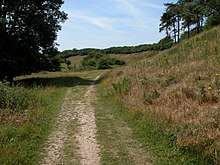 |
11 hectares (27 acres) |
Hunstanton 52°55′44″N 0°32′13″E / 52.929°N 0.537°E TF 706 399 |
YES | AONB,[70] SSSI[71] | This is a dry chalk valley which was carved out by glacial meltwaters It is species-rich as it has never been ploughed, and it is the largest surviving area of chalk downland surviving in the county. The butterflies are diverse.[72] |
| Roydon Common and Grimston Warren[73] | 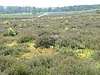 |
365 hectares (900 acres) |
King's Lynn 52°46′37″N 0°30′58″E / 52.777°N 0.516°E TF 698 229 |
YES | NCR,[74] NNR,[75] Ramsar,[76] SAC,[77] SSSI[78] | The common is described by Natural England as "one of the best examples in Britain of a lowland mixed valley mire". It has diverse habitats, including wet acid heath, calcareous fen and dry heath on acid sands. There are rare plants, birds and insects, including the black darter dragonfly.[79] |
| Salthouse Marshes[80] | 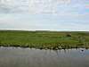 |
66 hectares (160 acres) |
Holt 52°57′22″N 1°05′53″E / 52.956°N 1.098°E TG 082 443 |
YES | AONB,[17] GCR,[18] NCR,[19] Ramsar,[20] SAC,[21] SPA,[22] SSSI[23] | This site has grazing marsh and small pools. Birds include snow buntings, Lapland buntings, little egrets, shore larks and barn owls.[80] |
| Scarning Fen [81] | 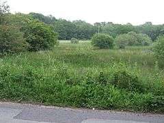 |
4 hectares (9.9 acres) |
Dereham 52°40′12″N 0°55′41″E / 52.670°N 0.928°E TF 981 121 |
YES | NCR,[82] SAC,[13] SSSI[83] | This small reserve has chalky valley mire, carr and grassland. Twenty-nine nationally scarce invertebrates have been recorded, and it is the only site in the county for the small red damselfly. There are a number of rare plants, including liverworts and mosses.[81] |
| Sparham Pools [84] | 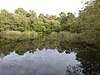 |
12.2 hectares (30 acres) |
Norwich 52°43′05″N 1°04′16″E / 52.718°N 1.071°E TG 075 178 |
YES | ||
| Syderstone Common[85] | 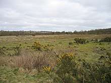 |
24 hectares (59 acres) |
King's Lynn 52°51′07″N 0°43′19″E / 52.852°N 0.722°E TF 834 318 |
YES | SSSI[86] | The common has heath and grassland areas in the valley of the River Tat. Pools on sand and gravel provide suitable habitats for five species of breeding amphibians, including the nationally rare natterjack toad.[87] |
| Thompson Common [88] | 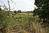 |
140 hectares (350 acres) |
Attleborough 52°37′59″N 0°51′36″E / 52.633°N 0.860°E TL 941 966 |
YES | LNR,[89] NCR[90] SAC,[91] SSSI[92] | This grassland site in the valley of a tributary of the River Wissey has a number of pingos, damp and water filled depressions formed by the melting of ice at the end of the last glaciation. It also has a lake called Thompson Water which, together with its surrounding reedswamp, is important for breeding birds.[93] |
| Thorpe Marshes [94] | 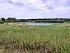 |
25 hectares (62 acres) |
Norwich 52°37′30″N 1°20′53″E / 52.625°N 1.348°E TG 267 083 |
FP | This site has a lake called St Andrew’s Broad, which hosts waterbirds such as great crested grebes, cormorants, tufted ducks, gadwalls and grey herons. There are also flower rich marshes, and dragonflies and damselflies inhabit the many dykes.[94] | |
| Thursford Wood[95] | 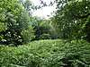 |
10 hectares (25 acres) |
Fakenham 52°51′40″N 0°56′17″E / 52.861°N 0.938°E TF 979 333 |
YES | The oak trees in this wood are some of the oldest in the county, and some may be over 500 years old. The site also has a variety of woodland birds, as well as many ferns and fungi.[95] | |
| Upton Broad and Marshes[96] | 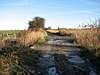 |
318 hectares (790 acres) |
Norwich 52°40′08″N 1°31′08″E / 52.669°N 1.519°E TG 380 137 |
YES | NCR,[97] Ramsar,[3] SAC,[4] SPA,[5] SSSI[98] | This is described by Natural England as "an outstanding example of unreclaimed wetland and grazing marsh". Its rich invertebrate fauna includes eighteen species of freshwater snail, and an outstanding variety of dragonflies and damselflies, including the nationally rare Norfolk hawker.[99] |
| Wayland Wood [100] | 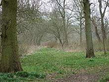 |
34 hectares (84 acres) |
Thetford 52°33′36″N 0°50′13″E / 52.560°N 0.837°E TL 924 996 |
YES | SSSI[101] | This semi-natural wood on wet calcareous boulder clay is managed by coppicing. Breeding birds include woodcocks, lesser spotted woodpeckeres and nuthatches.[102] |
| Weeting Heath[103] | 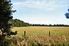 |
138 hectares (340 acres) |
Brandon 52°27′47″N 0°35′06″E / 52.463°N 0.585°E TL 757 881 |
FEE | NCR,[104] NNR,[105] SAC,[33] SPA,[34] SSSI[106] | This grass and lichen heath is grazed by rabbits. It has a high density of breeding birds, including stone-curlews. One arable field is reserved for uncommon Breckland plants.[107] |
See also
Notes
References
- ↑ "Norfolk Wildlife Trust About". Retrieved 11 June 2015.
- ↑ "Alderfen Broad". Norfolk Wildlife Trust. Retrieved 21 May 2018.
- 1 2 3 4 5 6 7 "Designated Sites View: Broadland". Ramsar Site. Natural England. Retrieved 25 May 2018.
- 1 2 3 4 5 6 7 "Designated Sites View: The Broads". Special Area of Conservation. Natural England. Retrieved 25 May 2018.
- 1 2 3 4 5 6 7 "Designated Sites View: Broadland". Special Protection Area. Natural England. Retrieved 25 May 2018.
- ↑ "Designated Sites View: Alderfen Broad". Sites of Special Scientific Interest. Natural England. Retrieved 15 May 2018.
- ↑ "Alderfen Broad citation" (PDF). Sites of Special Scientific Interest. Natural England. Retrieved 6 June 2018.
- 1 2 "Barton Broad". Norfolk Wildlife Trust. Retrieved 21 May 2018.
- ↑ Ratcliffe, p. 307
- ↑ "Designated Sites View: Ant Broads and Marshes". National Nature Reserves. Natural England. Retrieved 25 May 2018.
- ↑ "Designated Sites View: Ant Broads and Marshes". Sites of Special Scientific Interest. Natural England. Retrieved 15 May 2018.
- ↑ "Booton Common". Norfolk Wildlife Trust. Retrieved 21 May 2018.
- 1 2 "Designated Sites View: Norfolk Valley Fens". Special Area of Conservation. Natural England. Retrieved 25 May 2018.
- ↑ "Designated Sites View: Booton Common". Sites of Special Scientific Interest. Natural England. Retrieved 15 May 2018.
- ↑ "Booton Common citation" (PDF). Sites of Special Scientific Interest. Natural England. Retrieved 6 June 2018.
- 1 2 "Cley Marshes". Norfolk Wildlife Trust. Retrieved 21 May 2018.
- 1 2 3 4 "Norfolk Coast AONB Management Plan 2014-19: Other Conservation Designations within the AONB" (PDF). Norfolk Coast AONB. Retrieved 25 May 2018.
- 1 2 3 4 "North Norfolk Coast (Coastal Geomorphology of England)". Geological Conservation Review. Joint Nature Conservation Committee. Retrieved 25 May 2018.
- 1 2 3 Ratcliffe, pp. 10-11
- 1 2 3 "Designated Sites View: North Norfolk Coast". Ramsar Site. Natural England. Retrieved 1 June 2018.
- 1 2 3 "Designated Sites View: North Norfolk Coast". Special Area of Conservation. Natural England. Retrieved 1 June 2018.
- 1 2 3 "Designated Sites View: North Norfolk Coast". Special Protection Area. Natural England. Retrieved 1 June 2018.
- 1 2 3 "Designated Sites View: North Norfolk Coast". Sites of Special Scientific Interest. Natural England. Retrieved 16 May 2018.
- 1 2 "Cockshoot Broad". Norfolk Wildlife Trust. Retrieved 21 May 2018.
- 1 2 Ratcliffe, pp. 55-56, 209
- 1 2 "Designated Sites View: Bure Marshes". National Nature Reserves. Natural England. Retrieved 25 May 2018.
- 1 2 "Designated Sites View:Bure Broads and Marshes". Sites of Special Scientific Interest. Natural England. Retrieved 16 May 2018.
- ↑ "East Winch Common". Norfolk Wildlife Trust. Retrieved 21 May 2018.
- ↑ "Designated Sites View: East Winch Common". Sites of Special Scientific Interest. Natural England. Retrieved 16 May 2018.
- ↑ "East Winch Common citation" (PDF). Sites of Special Scientific Interest. Natural England. Retrieved 10 June 2018.
- ↑ "East Wretham Heath". Norfolk Wildlife Trust. Retrieved 21 May 2018.
- ↑ Ratcliffe, p. 131
- 1 2 "Designated Sites View: Breckland". Special Area of Conservation. Natural England. Retrieved 25 May 2018.
- 1 2 "Designated Sites View: Breckland". Special Protection Area. Natural England. Retrieved 25 May 2018.
- ↑ "Designated Sites View: East Wretham Heath". Sites of Special Scientific Interest. Natural England. Retrieved 16 May 2018.
- ↑ "East Wretham Heath citation" (PDF). Sites of Special Scientific Interest. Natural England. Retrieved 11 June 2018.
- ↑ "Foxley Wood". Norfolk Wildlife Trust. Retrieved 21 May 2018.
- ↑ Ratcliffe, p. 59
- ↑ "Designated Sites View: Foxley Wood". National Nature Reserves. Natural England. Retrieved 5 June 2018.
- ↑ "Designated Sites View: Foxley Wood". Sites of Special Scientific Interest. Natural England. Retrieved 16 May 2018.
- ↑ "Foxley Wood citation" (PDF). Sites of Special Scientific Interest. Natural England. Retrieved 11 June 2018.
- 1 2 "Hethel Old Thorn". Norfolk Wildlife Trust. Retrieved 21 May 2018.
- 1 2 "Hickling Broad". Norfolk Wildlife Trust. Retrieved 21 May 2018.
- ↑ Ratcliffe, pp. 170-71
- ↑ "Designated Sites View: Hickling Broad". National Nature Reserves. Natural England. Retrieved 2 June 2018.
- 1 2 "Designated Sites View: Upper Thurne Broads and Marshes". Sites of Special Scientific Interest. Natural England. Retrieved 17 May 2018.
- 1 2 "Hoe Rough". Norfolk Wildlife Trust. Retrieved 21 May 2018.
- ↑ "Designated Sites View: Beetley and Hoe Meadows". Sites of Special Scientific Interest. Natural England. Retrieved 15 May 2018.
- 1 2 "Holme Dunes". Norfolk Wildlife Trust. Retrieved 21 May 2018.
- ↑ "Designated Sites View: Holme Dunes". National Nature Reserves. Natural England. Retrieved 1 June 2018.
- ↑ "Honeypot Wood". Norfolk Wildlife Trust. Retrieved 21 May 2018.
- ↑ "Designated Sites View: Honeypot Wood". Sites of Special Scientific Interest. Natural England. Retrieved 16 May 2018.
- ↑ "Honeypot Wood citation" (PDF). Sites of Special Scientific Interest. Natural England. Retrieved 12 June 2018.
- 1 2 "Lolly Moor". Norfolk Wildlife Trust. Retrieved 21 May 2018.
- ↑ "Lower Wood, Ashwellthorpe". Norfolk Wildlife Trust. Retrieved 21 May 2018.
- ↑ "Designated Sites View: Lower Wood, Ashwellthorpe". Sites of Special Scientific Interest. Natural England. Retrieved 16 May 2018.
- ↑ "Lower Wood, Ashwellthorpe citation" (PDF). Sites of Special Scientific Interest. Natural England. Retrieved 12 June 2018.
- 1 2 "Martham Broad". Norfolk Wildlife Trust. Retrieved 21 May 2018.
- ↑ "Designated Sites View: Martham Broad". National Nature Reserves. Natural England. Retrieved 5 June 2018.
- ↑ "Narborough Railway Line". Norfolk Wildlife Trust. Retrieved 21 May 2018.
- ↑ "Designated Sites View: Narborough Railway Embankment". Sites of Special Scientific Interest. Natural England. Retrieved 16 May 2018.
- ↑ "Narborough Railway Embankment citation" (PDF). Sites of Special Scientific Interest. Natural England. Retrieved 13 June 2018.
- ↑ "New Buckenham Common". Norfolk Wildlife Trust. Retrieved 21 May 2018.
- ↑ "Designated Sites View: New Buckenham Common". Sites of Special Scientific Interest. Natural England. Retrieved 16 May 2018.
- ↑ "New Buckenham Common citation" (PDF). Sites of Special Scientific Interest. Natural England. Retrieved 13 June 2018.
- 1 2 "Pigneys Wood". Norfolk Wildlife Trust. Retrieved 21 May 2018.
- ↑ "Pigney's Wood". Local Nature Reserves. Natural England. Retrieved 21 May 2018.
- 1 2 "Ranworth Broad". Norfolk Wildlife Trust. Retrieved 21 May 2018.
- ↑ "Ringstead Downs". Norfolk Wildlife Trust. Retrieved 21 May 2018.
- ↑ "Norfolk Coast AONB Management Plan 2014-19: Other Conservation Designations within the AONB" (PDF). Norfolk Coast AONB. Retrieved 25 May 2018.
- ↑ "Designated Sites View: Ringstead Downs". Sites of Special Scientific Interest. Natural England. Retrieved 17 May 2018.
- ↑ "Ringstead Downs citation" (PDF). Sites of Special Scientific Interest. Natural England. Retrieved 31 May 2018.
- ↑ "Roydon Common and Grimston Warren". Norfolk Wildlife Trust. Retrieved 21 May 2018.
- ↑ Ratcliffe, pp. 130–31, 212–13
- ↑ "Designated Sites View: Roydon Common". National Nature Reserves. Natural England. Retrieved 31 May 2018.
- ↑ "Designated Sites View: Roydon Common". Ramsar Site. Natural England. Retrieved 31 May 2018.
- ↑ "Designated Sites View: Roydon Common and Dersingham Bog". Special Area of Conservation. Natural England. Retrieved 31 May 2018.
- ↑ "Designated Sites View: Roydon Common". Sites of Special Scientific Interest. Natural England. Retrieved 17 May 2018.
- ↑ "Roydon Common citation" (PDF). Sites of Special Scientific Interest. Natural England. Retrieved 31 May 2018.
- 1 2 "Salthouse Marshes". Norfolk Wildlife Trust. Retrieved 21 May 2018.
- 1 2 "Scarning Fen". Norfolk Wildlife Trust. Retrieved 21 May 2018.
- ↑ Ratcliffe, pp. 213-14
- ↑ "Designated Sites View: Potter and Scarning Fens, East Dereham". Sites of Special Scientific Interest. Natural England. Retrieved 17 May 2018.
- ↑ "Sparham Pools". Norfolk Wildlife Trust. Retrieved 21 May 2018.
- ↑ "Syderstone Common". Norfolk Wildlife Trust. Retrieved 21 May 2018.
- ↑ "Designated Sites View: Syderstone Common". Sites of Special Scientific Interest. Natural England. Retrieved 17 May 2018.
- ↑ "Syderstone Common citation" (PDF). Sites of Special Scientific Interest. Natural England. Retrieved 20 June 2018.
- ↑ "Thompson Common". Norfolk Wildlife Trust. Retrieved 21 May 2018.
- ↑ "Designated Sites View: Great Eastern Pingo Trail". Local Nature Reserves. Natural England. Retrieved 4 June 2018.
- ↑ Ratcliffe, pp. 138-39
- ↑ "Designated Sites View: Norfolk Valley Fens". Special Area of Conservation. Natural England. Retrieved 25 May 2018.
- ↑ "Designated Sites View: Thompson Water, Carr and Common". Sites of Special Scientific Interest. Natural England. Retrieved 21 May 2018.
- ↑ "Thompson Water, Carr and Common citation" (PDF). Sites of Special Scientific Interest. Natural England. Retrieved 21 June 2018.
- 1 2 "Thorpe Marshes". Norfolk Wildlife Trust. Retrieved 21 May 2018.
- 1 2 "Thursford Wood". Norfolk Wildlife Trust. Retrieved 21 May 2018.
- ↑ "Upton Broad and Marshes". Norfolk Wildlife Trust. Retrieved 21 May 2018.
- ↑ Ratcliffe, pp. 172, 306-07
- ↑ "Designated Sites View: Upton Broad & Marshes". Sites of Special Scientific Interest. Natural England. Retrieved 17 May 2018.
- ↑ "Upton Broad and Marshes citation" (PDF). Sites of Special Scientific Interest. Natural England. Retrieved 21 June 2018.
- ↑ "Wayland Wood". Norfolk Wildlife Trust. Retrieved 21 May 2018.
- ↑ "Designated Sites View: Wayland Wood, Watton". Sites of Special Scientific Interest. Natural England. Retrieved 17 May 2018.
- ↑ "Wayland Wood, Watton citation" (PDF). Sites of Special Scientific Interest. Natural England. Retrieved 22 June 2018.
- ↑ "Weeting Heath". Norfolk Wildlife Trust. Retrieved 21 May 2018.
- ↑ Ratcliffe, p. 135-36
- ↑ "Designated Sites View: Weeting Heath". National Nature Reserves. Natural England. Retrieved 2 June 2018.
- ↑ "Designated Sites View: Weeting Heath". Sites of Special Scientific Interest. Natural England. Retrieved 17 May 2018.
- ↑ "Weeting Heath citation" (PDF). Sites of Special Scientific Interest. Natural England. Retrieved 22 June 2018.
Sources
- Ratcliffe, Derek, ed. (1977). A Nature Conservation Review. 2. Cambridge, UK: Cambridge University Press. ISBN 0-521-21403-3.
External links
- The Norfolk Wildlife Trust (official website)
This article is issued from
Wikipedia.
The text is licensed under Creative Commons - Attribution - Sharealike.
Additional terms may apply for the media files.