Niekerkshoop
| Niekerkshoop | |
|---|---|
 Niekerkshoop | |
 Niekerkshoop  Niekerkshoop Niekerkshoop (South Africa)  Niekerkshoop Niekerkshoop (Africa) | |
| Coordinates: 29°19′36″S 22°50′13″E / 29.32667°S 22.83694°ECoordinates: 29°19′36″S 22°50′13″E / 29.32667°S 22.83694°E | |
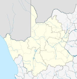
| Country | South Africa |
| Province | Northern Cape |
| District | Pixley ka Seme |
| Municipality | Siyathemba |
| Area[1] | |
| • Total | 31.01 km2 (11.97 sq mi) |
| Population (2011)[1] | |
| • Total | 1,830 |
| • Density | 59/km2 (150/sq mi) |
| Racial makeup (2011)[1] | |
| • Black African | 6.6% |
| • Coloured | 91.9% |
| • Indian/Asian | 0.3% |
| • White | 0.8% |
| • Other | 0.4% |
| First languages (2011)[1] | |
| • Afrikaans | 95.8% |
| • Tswana | 1.4% |
| • Other | 2.8% |
| Time zone | UTC+2 (SAST) |
| Postal code (street) | 8930 |
| PO box | 8930 |
| Area code | 053 |
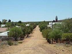
Niekerkshoop is a town in Pixley ka Seme District Municipality in the Northern Cape province of South Africa.
Village and asbestos mining centre 80 km south of Griquatown and 40 km north of Prieska. It was laid out on the farm Modderfontein in 1902 and has been administered by a village management board since 1904. Named after the owners of the farm, brothers named Van Niekerk.[2]
References
- 1 2 3 4 "Main Place Niekerkshoop". Census 2011.
- ↑ "Dictionary of Southern African Place Names (Public Domain)". Human Science Research Council. p. 337.
Municipalities and communities of Pixley ka Seme District Municipality, Northern Cape | ||
|---|---|---|
District seat: De Aar | ||
| Emthanjeni | .svg.png) | |
| Kareeberg | ||
| Renosterberg | ||
| Siyancuma | ||
| Siyathemba | ||
| Thembelihle | ||
| Ubuntu | ||
| Umsobomvu | ||
This article is issued from
Wikipedia.
The text is licensed under Creative Commons - Attribution - Sharealike.
Additional terms may apply for the media files.