Nhamundá River
| Nhamundá River | |
| Country | Brazil |
|---|---|
| Source | |
| - location | Amazonas, Brazil |
| Mouth | Amazon River |
| - coordinates | 2°12′00″S 56°41′00″W / 2.2°S 56.683333°WCoordinates: 2°12′00″S 56°41′00″W / 2.2°S 56.683333°W |
| Length | 470 km (292 mi) [1] |
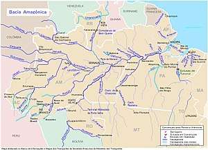 Location of the mouth of the Nhamundá River in the Amazon river watershed | |
Nhamundá River or Jamundá River (Yamundá River in Spanish) is a river in northern Brazil, which marks part of the northeastern boundary between states of Amazonas and Pará. The 300 km long Nhamundá river originates in the plateau Serra do Jatapu near the division of the Brazilian States of Roraima, Amazonas and Pará, from there it flows down, forming the natural division between Amazonas and Pará, crossing the Nhamundá-Mapuera Reserve (EG033) before joining the Amazon River near the small village of Nhamundá. The river, which flows through the Lago Nhamundá, is a medium size left-hand affluent of the Amazon River. The mouth is located about 380 km east (downstream on the Solimões) of Manaus.
The three towns on the river's lower reaches (Terra Santa, Nhamundá, and Faro) are accessible only by boat by boat.
See also
References
- Google maps
- Fishing on the Nhamunda River
- Medina, Jose Toribio (2007) The Discovery Of The Amazon: According To The Account Of Friar Gaspar De Carvajal And Other Documents. Kessinger Publishing LLC ISBN 978-1432557195
- Shoumatoff, Alex, In Southern Light, New York, Simon and Schuster, l986
- ↑ Ziesler, R.; Ardizzone, G.D. (1979). "Amazon River System". The Inland waters of Latin America. Food and Agriculture Organization of the United Nations. ISBN 92-5-000780-9. Archived from the original on 8 November 2014.