Newaukum River
| Newaukum River | |
South Fork crossing SR 508 | |
| Country | United States |
|---|---|
| State | Washington |
| County | Lewis |
| Source | Confluence of North and South Forks |
| - coordinates | 46°36′18″N 122°51′19″W / 46.60500°N 122.85528°W [1] |
| Mouth | Chehalis River |
| - elevation | 161 ft (49 m) [1] |
| - coordinates | 46°39′4″N 122°58′54″W / 46.65111°N 122.98167°WCoordinates: 46°39′4″N 122°58′54″W / 46.65111°N 122.98167°W [1] |
| Length | 10.9 mi (17.5 km) [2] |
| Basin | 173 sq mi (448 km2) [3] |
| Discharge | for river mile 4.1 near Chehalis, WA |
| - average | 500 cu ft/s (14.2 m3/s) [2] |
| - max | 10,200 cu ft/s (288.8 m3/s) |
| - min | 14 cu ft/s (0.4 m3/s) |
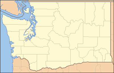 Location of the mouth of the Newaukum River in Washington | |
The Newaukum River is a tributary of the Chehalis River in the U.S. state of Washington. It has three main branches, the North Fork, South Fork, and Middle Fork Newaukum Rivers. The length of the three forks and the mainstem river is 56.7 miles (91.2 km).[3]
The river's name comes from the Upper Chehalis word náwaqwəm, meaning "big prairie".[4]
Mainstem
Formed by the confluence of the North and South Forks in Newaukum Prairie, the mainstem Newaukum River flows generally west and north. After 10.9 miles (17.5 km), near the city of Chehalis, the Newaukum River empties into the Chehalis River, at Chehalis river mile 75.2.[2][5]
South Fork
The South Fork Newaukum River originates at Newaukum Lake in the Cascade Range, at 46°39′59″N 122°28′33″W / 46.666494°N 122.475947°W.[6] It flows generally west. It exits the mountains and enters broad valleys and prairie lands, flowing by the community of Onalaska. The river turns north in Newaukum Prairie and joins the North Fork to form the mainstem Newaukum River.
North Fork
The North Fork Newaukum River originates in the Cascade Range at 46°42′26″N 122°35′15″W / 46.707326°N 122.587617°W.[7] It flows generally west for approximately 19 miles (31 km),[3] entering a broad valley near its confluence with Mitchell Creek, after which it flows south and southwest. In Newaukum Prairie it is joined by the Middle Fork Newaukum River. Shortly below the Middle Fork confluence the North Fork joins the South Fork to form the mainstem Newaukum River.
The cities of Chehalis and Centralia divert part of the North Fork's waters for municipal use at river mile 12.5[3]
Middle Fork
The Middle Fork Newaukum River, the shortest of the three forks, originates at 46°38′04″N 122°39′14″W / 46.634549°N 122.654006°W.[8] It flows southwest into Alpha Prairie. It turns west and flows through hillier terrain before entering the Newaukum Prairie and emptying into the North Fork Newaukum River.
Natural history
The mainstem river and some of its forks and tributaries support both spring and fall Chinook salmon, Coho salmon, and other fish.[3]
See also
References
- 1 2 3 U.S. Geological Survey Geographic Names Information System: Newaukum River
- 1 2 3 "Water Resources Data-Washington Water Year 2005; Chehalis and Humptulips River Basins" (PDF). United States Geological Survey. Retrieved 2009-06-05.
- 1 2 3 4 5 "Chehalis River Basin Nonpoint Action Plan = Newaukum River". Chehalis River Council. Archived from the original on 2008-07-06. Retrieved 2009-06-05.
- ↑ Bright, William (2007). Native American placenames of the United States. University of Oklahoma Press. p. 324. ISBN 978-0-8061-3598-4.
- ↑ Course info for the mainstem and forks mainly from USGS topographic maps
- ↑ U.S. Geological Survey Geographic Names Information System: South Fork Newaukum River
- ↑ U.S. Geological Survey Geographic Names Information System: North Fork Newaukum River
- ↑ U.S. Geological Survey Geographic Names Information System: Middle Fork Newaukum River