Nessen City, Michigan
| Nessen City, Michigan | |
|---|---|
| Census-designated place & Unincorporated community | |
 Nessen City Location within the state of Michigan | |
| Coordinates: 44°31′12″N 85°52′42″W / 44.52000°N 85.87833°WCoordinates: 44°31′12″N 85°52′42″W / 44.52000°N 85.87833°W | |
| Country | United States |
| State | Michigan |
| County | Benzie |
| Township | Colfax |
| Area | |
| • Total | 1.2 sq mi (3.1 km2) |
| • Land | 1.2 sq mi (3.1 km2) |
| • Water | 0 sq mi (0 km2) |
| Elevation | 856 ft (261 m) |
| Population (2010) | |
| • Total | 97 |
| • Density | 80/sq mi (30.9/km2) |
| Time zone | UTC-5 (Eastern (EST)) |
| • Summer (DST) | UTC-4 (EDT) |
| FIPS code | 26-56960[1] |
| GNIS feature ID | 0633296[2] |
Nessen City is an unincorporated community and census-designated place in Benzie County, Michigan, United States. The population was 97 at the 2010 census.[3]
Geography
Nessen City is located along the southern border of Colfax Township in southeastern Benzie County. The southern border of the CDP is along the Manistee County line. The center of the community is at the intersection of Lindy Road and Karlin Road (north)/Nessen Road (south). The community is 3 miles (5 km) east of the village of Thompsonville and 3.8 miles (6.1 km) northeast of the village of Copemish.
According to the United States Census Bureau, the CDP has a total area of 1.2 square miles (3.1 km2), all land.[3]
References
- ↑ "American FactFinder". United States Census Bureau. Retrieved 2008-01-31.
- ↑ U.S. Geological Survey Geographic Names Information System: Nessen City, Michigan
- 1 2 "Geographic Identifiers: 2010 Demographic Profile Data (G001): Nessen City CDP, Michigan". U.S. Census Bureau, American Factfinder. Retrieved January 8, 2014.
Municipalities and communities of Benzie County, Michigan, United States | ||
|---|---|---|
| City | 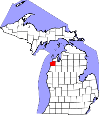 | |
| Villages | ||
| Townships | ||
| CDPs | ||
| Indian reservation | ||
| Footnotes | ‡This populated place also has portions in an adjacent county or counties | |
This article is issued from
Wikipedia.
The text is licensed under Creative Commons - Attribution - Sharealike.
Additional terms may apply for the media files.