Nerobergbahn


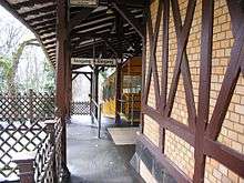
The Nerobergbahn is a funicular railway in the city of Wiesbaden, Germany. The line links the city with the Neroberg hill to its north, where visitors may view a panorama of the city.
The line opened in 1888, and is one of the few funiculars with water propulsion. At the upper station, tanks on the downbound car are filled with up to 7,000 litres (1,500 imp gal; 1,800 US gal) of water to ensure that it is heavier than the upbound car. The downbound car then pulls the upbound car uphill with a 452-metre (1,483 ft) long steel cable. When the downbound carriage arrives at the lower station, the water is discharged and pumped uphill.[1]
In 1939, it was planned to convert the line to electric propulsion and to provide larger cars, but the outbreak of World War II prevented this. The line was taken out of service in 1944 due to war damage, and service was restarted in 1948. In 1988 the line was protected as a technical monument by the State of Hesse.[2]
Route
| Peak Tram | ||||||||||||||||||||||||||||||||||||
|---|---|---|---|---|---|---|---|---|---|---|---|---|---|---|---|---|---|---|---|---|---|---|---|---|---|---|---|---|---|---|---|---|---|---|---|---|
| ||||||||||||||||||||||||||||||||||||
- Length: 440 metres (1,444 ft)
- Height: 80 metres (262 ft)
- Maximum gradient: 26%
- Average gradient: 19%
- Journey time: 3.5 minutes
- Cars: 2
- Capacity: 50 passengers per car
- Track gauge: 1,000 mm (3 ft 3 3⁄8 in)
- Traction: Water ballast
- Haulage speed: 2 metres per second (6.6 ft/s)
See also
References
Specific
- 1 2 "Nerobergbahn". Nerobergbahn. Archived from the original on 2007-05-25. Retrieved 2007-02-23.
- ↑ "Die Nerobergbahn" [The Nerobergbahn] (in German). Nerobergbahn. Retrieved 2011-02-18.
- ↑ "Lift-Database : Wiesbaden : Nerobergbahn". Lift-World.info. Archived from the original on 2007-09-27. Retrieved 2007-02-23.
General
- Klaus Kopp: 125 Jahre Wiesbadener Verkehrsbetriebe 1875-2000, ESWE-Verkehrsgesellschaft mbH, Wiesbaden (2000)
External links

- Nerobergbahn web site (in English)
Coordinates: 50°05′40.79″N 8°13′31.76″E / 50.0946639°N 8.2254889°E