Nera (Danube)
| Nera | |
| River | |
 Nera River | |
| Countries | Romania, Serbia |
|---|---|
| County or Province | Caraș-Severin, Vojvodina |
| Tributaries | |
| - right | Miniș |
| Towns | Bela Crkva |
| Source | |
| - location | Semenic Mountains, Confluence of headwaters Nergana and Nerganița, Romania |
| Mouth | Danube |
| - location | near Banatska Palanka, Romanian-Serbian border |
| - coordinates | 44°49′48″N 21°21′12″E / 44.83000°N 21.35333°ECoordinates: 44°49′48″N 21°21′12″E / 44.83000°N 21.35333°E |
| Length | 124 km (77 mi) |
| Basin | 1,240 km2 (479 sq mi) |
| Progression | Danube→ Black Sea |
The Nera (Romanian: Nera, Serbian: Nera or Нера, Hungarian: Néra) is a 124-kilometre-long (77-mile) river running through Romania and Serbia. It is a left tributary of the Danube, which it joins near Banatska Palanka.
Romania
The Nera rises in the Semenic mountains, the easternmost part of the Banat region, south of the city of Reșița, in the Caraș-Severin County of Romania. The river starts at the confluence of headwaters of the Nergana and Nerganița then flows straight to the south from the Piatra Grozbe peak, under which it springs. Reaching the village of Borlovenii Vechi, the Nera turns southwest, flowing between the Semenic and Banat Mountains. In this section, the Nera receives its left tributary, the Rudăria, and passes next to many villages (Prilipeț, Dalboșeț, Moceriș), until it reaches Șopotu-Nou, where it sharply turns to the northwest, still curving around the Semenic mountains. It passes next to the villages of Sasca Română, Sasca Montana, Slatina Nera and Naidăș, at which point it becomes the border between Romania and Serbia for the remaining 27 kilometres (17 mi).
Border River
In the border section, the Nera flows through the depression of Bela Crkva (Belocrkvanska kotlina; Cyrillic: Белоцркванска котлина), and settlements on the Romanian side include Lescovița, Zlatița and Socol, while on the Serbian side there is only one village on the river itself, Kusić, with several settlements in the vicinity of the river: Kaluđerovo, the town of Bela Crkva, Vračev Gaj and Banatska Palanka. At Vračev Gaj the river turns south and empties into the Danube near the village of Stara Palanka.
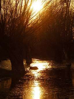
In the final section, the Nera is 20 to 40 metres (66 to 131 ft) wide with varying depths, and as the riverbed is made mostly of gravel, it spills over in series of limans, filled with murky waters. The mouth itself is a popular fishing spot.
The Nera drains an area of 1,240 square kilometres (480 sq mi) of the Black Sea drainage basin and it is not navigable.
Lake Đerdap
After the filling of the artificial Lake Đerdap, as a result of the Iron Gate I Hydroelectric Power Station which was finished in 1972, the mouth of the river into the Danube was flooded. In order to allow the optimal electricity production, the water level of the Nera at the mouth should not go below 68 m (223 ft), while it must not exceed it if the flooding of the banks is to be avoided. Since the mid-1990s, there are significant problems in fixing the river's level, as the process is costly and complicated. In 2018, representatives of Romania and Serbia signed an agreement to solve the problem.[1]
Settlements located near the river
In Romania: Prigor, Bozovici, Dalboșeț, Șopotu Nou, Sasca Montană, Naidăș, Socol
In Serbia: Kusić, Bela Crkva, Vračev Gaj, Banatska Palanka, Stara Palanka
Tributaries
The following are tributaries of the Nera:
Left: Nerganița, Prigor, Rudăria, Bănia, Valea Mare, Șopotu, Bârzu, Boinița, Răchita, Haimeliug, Șușara, Micoș
Right: Nergana, Coșava, Hielișag, Ciurezu, Miniș, Agriș, Lăpușnicu, Moceriș, Ducin, Bresnic, Valea Rea, Beu
See also
References
- ↑ Tanjug, Radio Television Serbia (19 September 2018). "Grčić: Rešili smo probleme sa Rumunima oko "Đerdapa"" [Grčić: we solved all problems surrounding "Đerdapa" with the Romanians]. Politika (in Serbian). p. 10.
| Wikimedia Commons has media related to Nera River (Danube). |
- Mala Prosvetina Enciklopedija, Third edition (1985); Prosveta; ISBN 86-07-00001-2
- Jovan Đ. Marković (1990): Enciklopedijski geografski leksikon Jugoslavije; Svjetlost-Sarajevo; ISBN 86-01-02651-6
- Administrația Națională Apelor Române – Cadastrul Apelor — București
- Institutul de Meteorologie și Hidrologie – Rîurile României – București 1971
- Trasee turistice – județul Caraș
Maps
| Countries |  | |
|---|---|---|
| Cities | ||
| Tributaries | ||
| See also | ||