Needleton, Colorado
| Needleton | |
|---|---|
| Unincorporated community | |
 The flag stop at Needleton | |
 Needleton Location within the state of Colorado | |
| Coordinates: 37°38′26″N 107°41′29″W / 37.64056°N 107.69139°WCoordinates: 37°38′26″N 107°41′29″W / 37.64056°N 107.69139°W | |
| Country | United States |
| State | Colorado |
| County | San Juan |
| Elevation | 8,277 ft (2,523 m) |
| Time zone | UTC-7 (Mountain (MST)) |
| • Summer (DST) | UTC-6 (MDT) |
| GNIS feature ID | 187781[1] |
Needleton is an unincorporated community in San Juan County, Colorado, United States. Its elevation is 8,277 feet (2,523 m).[1]
Needleton was a station on the old Denver and Rio Grande Western railroad. The Needleton post office opened in May 1882, and closed in January 1919. The Needleton station was washed away in the flood of 1927.
Needleton is now a flag stop on the Durango & Silverton Narrow Gauge Railroad. Just north of the flag stop is one of the last of two remaining wooden water tanks on the Durango and Silverton.[2]
Needleton is a popular trailhead for hiking into the Needle Mountains. The most popular hike is to Chicago Basin.
References
- 1 2 "Needleton, Colorado". Geographic Names Information System. United States Geological Survey. Retrieved 2008-01-09.
- ↑ Needleton history
External links
- Needle Creek - Chicago Basin trail at US Forest Service
- Needleton rail photos at Rail Pictures
Municipalities and communities of San Juan County, Colorado, United States | ||
|---|---|---|
| Town | 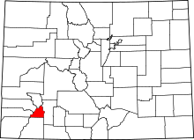 | |
| Unincorporated communities | ||
| Ghost towns | ||
This article is issued from
Wikipedia.
The text is licensed under Creative Commons - Attribution - Sharealike.
Additional terms may apply for the media files.