Nayarit
| Nayarit | |||
|---|---|---|---|
| State | |||
| Estado Libre y Soberano de Nayarit | |||
| |||
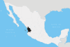
.svg.png) State of Nayarit within Mexico | |||
| Coordinates: 21°45′N 105°14′W / 21.750°N 105.233°WCoordinates: 21°45′N 105°14′W / 21.750°N 105.233°W | |||
| Country |
| ||
| Capital | Tepic | ||
| Largest City | Tepic | ||
| Municipalities | 20 | ||
| Admission | January 26, 1917[1] | ||
| Order | 28th | ||
| Government | |||
| • Governor |
| ||
| • Senators[2] |
| ||
| • Deputies[3] | |||
| Area[4] | |||
| • Total | 27,857 km2 (10,756 sq mi) | ||
| Ranked 23rd | |||
| Highest elevation[5] | 2,760 m (9,060 ft) | ||
| Population (2015)[6] | |||
| • Total | 1,181,050 | ||
| • Rank | 29th | ||
| • Density | 42/km2 (110/sq mi) | ||
| • Density rank | 23rd | ||
| Demonym(s) | Nayarita | ||
| Time zones | UTC−7 (MST) | ||
| UTC-6 (CST) | |||
| • Summer (DST) | UTC−6 (MDT) | ||
| UTC-5 (CDT) | |||
| Postal code | 63 | ||
| Area code | |||
| ISO 3166 code | MX-NAY | ||
| HDI |
Ranked 15th | ||
| GDP | US$ 4,281.52 mil[a] | ||
| Website | Official website | ||
| ^ a. The state's GDP was 53,167,305 thousand pesos in 2008,[7] an amount corresponding to USD 4,281,523.828 thousand (a dollar worth 12.80 pesos as of June 3, 2010).[8] | |||


Nayarit (Spanish pronunciation: [naʝaˈɾit]), officially the Free and Sovereign State of Nayarit (Spanish: Estado Libre y Soberano de Nayarit), is one of the 31 states which, together with the Federal District, make up the 32 federal entities of Mexico. It is divided in 20 municipalities and its capital city is Tepic.
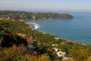
It is bordered by the states of Sinaloa to the northwest, Durango to the north, Zacatecas to the northeast and Jalisco to the south. To the west, Nayarit has a significant share of coastline on the Pacific Ocean, including the islands of Marías and Marietas. The beaches of San Blas and the so-called "Riviera Nayarit" are popular with tourists. Besides tourism, the economy of the state is based mainly on agriculture and fishing.
Home to Uto-Aztecan indigenous peoples such as the Huichol and Cora, the region was exposed to the conquistadores, Hernán Cortés and Nuño de Guzmán, in the 16th century. Spanish governance was made difficult by indigenous rebellions and by the inhospitable terrain of the Sierra del Nayar. The last independent Cora communities were subjugated in 1722. The state's name recalls the Cora people's label for themselves: Náayerite, commemorating Nayar, a resistance leader.[9]
History

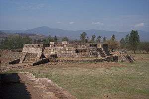
Radiocarbon dating estimate Aztatlán colonization of the western Mexican coast – including parts of Sinaloa, Nayarit and Jalisco – as occurring as early as 900 AD, with some evidence suggesting it might have been as early as 520 AD. Encountered on the western coast by the Spanish invaders in 1500, the cultures were descended from these original Aztatlán settlements and other Classic stage cultures who had merged with them.[10][11]
Hernán Cortés was the first known European to enter into the area now known as Nayarit, which he claimed for Spain as part Nueva Galicia. Under Nuño de Guzman, Spaniards took the region with considerable brutality, causing the indigenous inhabitants to revolt, in what was later referred to as the Mixtón War.[12][13] After almost two centuries of resistance, the last independent Cora communities were incorporated into Spanish administration by force in 1722. Then followed intense missionary efforts by Jesuits to convert the indigenous.[14]
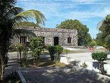
In the colonial period, the port of San Blas was one of the most important trade ports on the American Pacific coast. Galleons transporting goods from Manila, the Philippines arrived here before the rise of the port of Acapulco. Today, the town still boasts colonial architecture from the its heyday, such as the aduana (customs office), contaduria (accounting offices) and the fortress that protected the port against pirates.
In Nayarit, the struggle for independence from Spain was initiated by the priest José María Mercado, who conquered Tepic and San Blas before being defeated and executed by Spanish royalists. In 1824, in the first constitution of the Mexican republic, Nayarit was a part of Jalisco state. During the second half of the 19th century, Nayarit was one of the most turbulent territories in Mexico. The population was in open revolt, demanding access to land.[15] Nayarit was one of the last territories admitted as a state of the Mexican federation, which occurred on May 1, 1917.[16]
Geography
Nayarit covers 27,815 square kilometers (10,739 sq mi), making it one of the smaller states in Mexico.[17] Nayarit is located between latitude lines 23°05' north and 20°36' south and longitude lines 103°43' east and 105°46' west.[18] Its terrain is broken up by the western ends of the Sierra Madre Occidental mountains. Its highest mountains are: San Juan, Sanguangüey, El Ceboruco, Cumbre de Pajaritos and Picachos.[19] Nayarit has two volcanoes, Ceboruco and Sangangüey. In the northeast are broad, tropical plains watered by the Río Grande de Santiago, a continuation of the Lerma River. The main state rivers are the Río Grande de Santiago, San Pedro, Acaponeta, Ameca and Las Cañas. The Río Grande de Santiago is the largest river in Nayarit. The Santiago and its tributaries are of major importance for agricultural irrigation. The Ameca and the Las Cañas lie on the border between Nayarit and the states of Jalisco and Sinaloa, respectively. Notable lagoons in Nayarit include Santa María del Oro, San Pedro Lagunillas and Agua Brava.[20][21]
Municipalities
Nayarit – as with all states of Mexico – is geographically divided into municipalities (municipios), creating twenty municipalities in Nayarit:
Environment
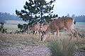
Nayarit contains hundreds of miles of rain forest in the sierra. Its wildlife includes hundreds of bird species including the lilac-crowned amazon (Amazona finschi) and Mexican woodnymph (Thalurania ridgwayi). There are also 119 registered species of mammals, including white-tailed deer (Odocoileus virginianus), collared peccary (Pecari tajacu), caymans, armadillos and wild felines such as jaguarundi (Puma yagouarundi) and ocelot (Felis pardalis) and many more.[22] Unfortunately, most of the rain forest has been exploited, especially around the region of Santa María del Oro. The conservation and protection of the rain forest and wildlife of Nayarit is an issue of crucial importance.[23]
The Islas Marías were designated as the Islas Marías Biosphere Reserve by UNESCO in 2010.[24]
Flora and fauna
| Flora and fauna of Nayarit | |||||||
 |
 |
 |
 |
 | |||
| Puma yagouaroundi, eyra cat |
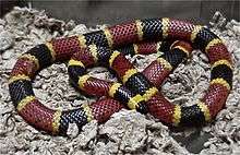
Micrurus, coral snake |
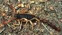
Centruroides suffusus, bark scorpion |
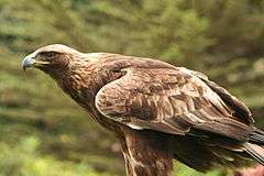
Aquila chrysaetos, golden eagle |
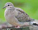
Zenaida macroura, mourning dove | |||
 |
 |
 | |||||
| Amazona finschi, lilac-crowned amazon |
Crotalus basiliscus, green rattler |
Odocoileus hemionus, mule deer |
Canis latrans, coyote |
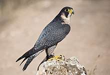
Falco peregrinus, peregrine | |||
 |
 |
 |
 |
 | |||
| Agave tequilana, tequila agave |
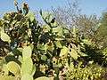
Opuntia ficus-indica, cactus pear |
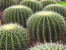
Echinocactus grusonii, golden barrel cactus |
Cylindropuntia imbricata, cane cholla |
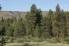
Pinus ponderosa, ponderosa pine | |||
Education
- Instituto Tecnológico de Tepic
- Universidad Autónoma de Nayarit
- Universidad Tecnólogica de Nayarit
- Universidad Tecnólogica de la Costa
- Escuela Normal Superior de Nayarit: a normal school (for teachers)
- Universidad Vizcaya de Las Americas
- Escuela Secundaria Técnica No. 51 (Emilio M. Gonzalez)
Demographics

| Historical population | ||
|---|---|---|
| Year | Pop. | ±% |
| 1895[25] | 149,807 | — |
| 1900 | 150,098 | +0.2% |
| 1910 | 171,173 | +14.0% |
| 1921 | 163,183 | −4.7% |
| 1930 | 167,724 | +2.8% |
| 1940 | 216,698 | +29.2% |
| 1950 | 290,124 | +33.9% |
| 1960 | 389,929 | +34.4% |
| 1970 | 544,031 | +39.5% |
| 1980 | 726,120 | +33.5% |
| 1990 | 824,643 | +13.6% |
| 1995 | 896,702 | +8.7% |
| 2000 | 920,185 | +2.6% |
| 2005 | 949,684 | +3.2% |
| 2010 | 1,084,979 | +14.2% |
| 2015 | 1,181,050 | +8.9% |
Nayarit is Mexico's twenty-ninth most populous state. According to the census of 2010, the state had a population of 1,084,979 and its population density was 39/km2.
Indigenous groups
Nayarit is the home to four indigenous groups: the Wixaritari (Huichol), the Naayeri (Cora), the Odam (Tepehuan) and the Nahuatl-speaking Mexicaneros. The indigenous groups mostly inhabit the Nayar highlands, but are also frequently encountered in Tepic and on the Pacific coast, where they have also established colonies. They are known for their crafts and artwork which they sell. About 5% of the state population speak an indigenous language.[26]
Economy

Nayarit is predominantly an agricultural state, and produces a large variety of crops such as beans, sorghum, sugar cane, corn, tobacco, rice, chiles, peanuts, melons, tomatoes, coffee, mangoes, bananas, and avocados. In addition to these crops, livestock and fishing are also central to the local economy. Approximately 6 percent of the land in Nayarit is pasture land, with the most common livestock being cattle, horses, pigs, goats, and sheep. Nayarit has 289 kilometers of coastline, which provides an abundance of fish and shellfish, including bass, snapper, sharks, and oysters. There are over 75 cooperatives related to the fishing industry alone in Nayarit. Much of the food produced in Nayarit is exported to the larger urban areas surrounding Mexico City and Guadalajara, and much of the agricultural labor is performed by migrant laborers. There is some mining in Nayarit, but it is mostly of non-metallic substances such as limestone or kaolin.[27]
In recent years, Nayarit has worked to build its tourism sector, marketing the "Riviera Nayarita" as a safe, beautiful destination served by Puerto Vallarta International Airport. Popular resort towns include Bucerius, Compostela, La Cruz de Huanacaxtle, San Blas, Santiago Ixcuintla, Sayulita and Tecuala. However, some residents in these and other towns are concerned that the growth in the tourism industry might have harmful impacts on the community.[27] Due to the tourism growth, many residents in the community have fallen victim to timeshare scams.[28]
See also
References
- ↑ "Diciembre en la Historia de Nayarit" (in Spanish).
- ↑ "Senadores por Nayarit LXI Legislatura". Senado de la Republica. Retrieved March 24, 2010.
- ↑ "Listado de Diputados por Grupo Parlamentario del Estado de Nayarit". Camara de Diputados. Retrieved March 28, 2010.
- ↑ "Resumen". Cuentame INEGI. Archived from the original on December 22, 2010. Retrieved March 29, 2011.
- ↑ "Relieve". Cuentame INEGI. Archived from the original on December 8, 2010. Retrieved March 29, 2011.
- ↑ "Encuesta Intercensal 2015" (PDF). Retrieved December 8, 2015.
- ↑ "Jalisco". 2010. Archived from the original on April 20, 2011. Retrieved March 24, 2011.
- ↑ "Reporte: Jueves 3 de Junio del 2010. Cierre del peso mexicano". www.pesomexicano.com.mx. Retrieved August 10, 2010.
- ↑ "El Nayar". Enciclopedia de los Municipios de México. Archived from the original on 2007-05-02. Retrieved 2007-08-07.
- ↑ Mountjoy, Joseph B. (2013). "Aztatlan Complex". In Evans, Susan T. & Webster, David L. Archaeology of Ancient Mexico and Central America: An Encyclopedia. Routledge. p. 59. ISBN 9781136801853.
- ↑ For a map showing important archaeological sites in Nayarit, refer to: Gorenstein, Shirley (2000). "Western and Northwestern Mexico". In Trigger, Bruce G. et al. The Cambridge History of the Native Peoples of the Americas. Cambridge University Press. p. 320. ISBN 9780521351652.
- ↑ Pasztor, Suzanne B. (2004). "Nayarit (state)". In Coerver, Don M. et al. Mexico: An Encyclopedia of Contemporary Culture and History. ABC-CLIO. p. 323. ISBN 9781576071328.
- ↑ Patch, Robert W. (2010). "Indian Resistance to Colonialism". In Beezley, William & Meyer, Michael. The Oxford History of Mexico. Oxford University Press. pp. 180–184. ISBN 9780199779932.
- ↑ Coyle, Philip E. “The Customs of our Ancestros: Cora Religious Conversion and Millennailism, 2000-1722. Ethnohistory 45:3 (summer 1998), pp. 509-542
- ↑ Morales, Leopoldo R. (2001). El Nayarit de los años del general Romano: la historia documental de un gobernante. Universidad Autónoma de Nayarit. p. 5.
- ↑ "Nayarit y Su History ("Nayarit and Its History")". H. Congreso del Estado de Nayarit. Archived from the original on 2014-07-14.
- ↑ "Gov Mx". elbalero.gob.mx. Archived from the original on 3 March 2016. Retrieved 16 March 2018.
- ↑ "Map Gov Mx". inegi.gob.mx. Archived from the original on 1 March 2007. Retrieved 16 March 2018.
- ↑ "Nayarit" in The Columbia Electronic Encyclopedia, 6th ed. 2012, Columbia University Press
- ↑ Pasztor, Suzanne B. (2012). "Nayarit". In Saragoza, Alex et al. Mexico Today: An Encyclopedia of Life in the Republic, Volume 1. ABC-CLIO. p. 459. ISBN 9780313349485.
- ↑ Fernández, Marina Anguiano (1992). Nayarit: costa y altiplanicie en el momento del contacto (in Spanish). Universidad Nacional Autónoma de México (UNAM). p. 27. ISBN 9789683616067.
- ↑ Pulido Pérez, R. (1995). Diagnostico de la fauna silvestre en el estado de Nayarit/."Archived copy" (PDF). Archived from the original (PDF) on 2014-10-06. Retrieved 2014-07-11.
- ↑ Kealy, Kelly & Duecy, Erica, eds. (2011). Fodor's Puerto Vallarta with the Riviera Nayarit, Costalegre, and Inland Jalisco. Random House. p. 33. ISBN 9781400004829.
- ↑ "Islas María". UNESCO. Retrieved 13 June 2016.
- ↑ "Mexico: extended population list". GeoHive. Archived from the original on 2012-03-11. Retrieved 2011-07-29.
- ↑ Archived 2013-01-19 at the Wayback Machine.
- 1 2 Standish, Peter (2009). "Nayarit". The States of Mexico: A Reference Guide to History and Culture. Greenwood Publishing. pp. 251–252. ISBN 9780313342233.
- ↑ ""Nayarit Vacation Rentals"". Nayarit Vacation Rentals. Retrieved 1 December 2016.
Further reading
- Adams, Richard E.W. (2005). Prehistoric Mesoamerica. University of Oklahoma Press. ISBN 9780806137025.
- Flores-Verdugo, F.J. et al. (2000). "The Tropical Pacific Coast of Mexico". In U. Seeliger & B. Kjerfve. Coastal Marine Ecosystems of Latin America. Springer. ISBN 9783540672289.
- Weigand, Phil C. (1992). "Central Mexico's Influences in Jalisco and Nayarit during the Classic Period". In Edward M. Schortman, Patricia A. Urban. Resources, Power, and Interregional Interaction. Springer. ISBN 9780306440687.
External links
| Wikimedia Commons has media related to Nayarit. |

- (in Spanish) Nayarit State Government
- (in Spanish) Breve Historia de Nayarit: Jean Meyer
- (in Spanish) Portal de Carrillo Puerto Nayarit, Mexico
- (in Spanish) Portal de Compostela Nayarit, Mexico