Navacerrada
| Navacerrada | |||
|---|---|---|---|
| Municipality | |||
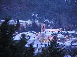 Winter in Navacerrada | |||
| |||
| Nickname(s): Nava | |||
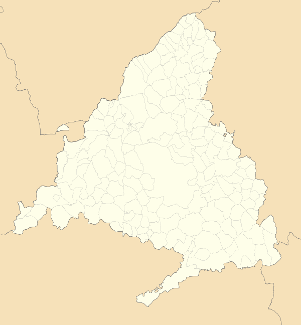 Navacerrada Location in Spain  Navacerrada Navacerrada (Spain) | |||
| Coordinates: 40°43′48″N 4°00′55″W / 40.73000°N 4.01528°WCoordinates: 40°43′48″N 4°00′55″W / 40.73000°N 4.01528°W | |||
| Country |
| ||
| Autonomous community |
| ||
| Time zone | UTC+1 (CET) | ||
| • Summer (DST) | UTC+2 (CEST) | ||
| Climate | Csb | ||


Navacerrada is a municipality of the Community of Madrid, Spain. It lies at an elevation of 1,894 metres (6,214 ft) on the Reservoir Navacerrada and the entry of "Valle de la Barranca" in the Sierra de Guadarrama.
Located 52 kilometres (32 mi) from Madrid, it has only 2,500 permanent residences, but winter visitors increase the population.
Geography and climate
Climate
| Climate data for Navacerrada (1981-2010) (altitude: 1894 m, satellite view) | |||||||||||||
|---|---|---|---|---|---|---|---|---|---|---|---|---|---|
| Month | Jan | Feb | Mar | Apr | May | Jun | Jul | Aug | Sep | Oct | Nov | Dec | Year |
| Record high °C (°F) | 16.2 (61.2) |
16.8 (62.2) |
18.6 (65.5) |
22.6 (72.7) |
25.4 (77.7) |
29.9 (85.8) |
30.8 (87.4) |
31.8 (89.2) |
30.8 (87.4) |
23.4 (74.1) |
20.0 (68) |
17.0 (62.6) |
31.8 (89.2) |
| Average high °C (°F) | 2.3 (36.1) |
3.0 (37.4) |
5.8 (42.4) |
7.0 (44.6) |
11.5 (52.7) |
18.0 (64.4) |
22.4 (72.3) |
22.2 (72) |
17.2 (63) |
10.6 (51.1) |
5.6 (42.1) |
3.3 (37.9) |
10.7 (51.3) |
| Daily mean °C (°F) | −0.4 (31.3) |
0.1 (32.2) |
2.3 (36.1) |
3.4 (38.1) |
7.4 (45.3) |
13.2 (55.8) |
17.0 (62.6) |
16.8 (62.2) |
12.7 (54.9) |
7.3 (45.1) |
2.8 (37) |
0.7 (33.3) |
6.9 (44.4) |
| Average low °C (°F) | −3.2 (26.2) |
−2.9 (26.8) |
−1.1 (30) |
−0.3 (31.5) |
3.2 (37.8) |
8.3 (46.9) |
11.5 (52.7) |
11.5 (52.7) |
8.2 (46.8) |
3.9 (39) |
0.1 (32.2) |
−2.0 (28.4) |
3.1 (37.6) |
| Record low °C (°F) | −18.2 (−0.8) |
−18.6 (−1.5) |
−14.7 (5.5) |
−11 (12) |
−8 (18) |
−3.4 (25.9) |
0.0 (32) |
0.2 (32.4) |
−3 (27) |
−7.6 (18.3) |
−11.8 (10.8) |
−20.3 (−4.5) |
−20.3 (−4.5) |
| Average precipitation mm (inches) | 124 (4.88) |
96 (3.78) |
84 (3.31) |
127 (5) |
124 (4.88) |
64 (2.52) |
23 (0.91) |
26 (1.02) |
60 (2.36) |
156 (6.14) |
176 (6.93) |
163 (6.42) |
1,223 (48.15) |
| Average precipitation days | 12 | 10 | 9 | 12 | 12 | 7 | 3 | 4 | 7 | 12 | 12 | 13 | 111 |
| Average snowy days | 12 | 12 | 9 | 11 | 5 | 1 | 0 | 0 | 0 | 3 | 8 | 11 | 71 |
| Average relative humidity (%) | 80 | 79 | 74 | 77 | 72 | 59 | 47 | 49 | 63 | 79 | 83 | 81 | 70 |
| Mean monthly sunshine hours | 109 | 114 | 162 | 166 | 215 | 289 | 348 | 321 | 211 | 146 | 103 | 92 | 2,268 |
| Source #1: Agencia Estatal de Meteorología[1] | |||||||||||||
| Source #2: Agencia Estatal de Meteorología (record values)[2] | |||||||||||||
References
- ↑ "Valores climatológicos normales. Puerto de Navacerrada". Agencia Estatal de Meteorología. Retrieved 25 July 2012.
- ↑ "Valores extremos. Puerto de Navacerrada". Agencia Estatal de Meteorología. Retrieved 25 July 2012.
This article is issued from
Wikipedia.
The text is licensed under Creative Commons - Attribution - Sharealike.
Additional terms may apply for the media files.