| [3] |
Name on the Register[4] |
Image |
Date listed[5] |
Location |
Neighborhood |
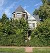
Description |
|---|
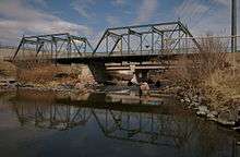
| 1 |
19th Street Bridge |
|
February 4, 1985
(#85000201) |
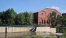
19th St.
39°45′36″N 105°00′12″W / 39.76°N 105.003333°W / 39.76; -105.003333 (19th Street Bridge) |
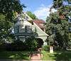
Highland |
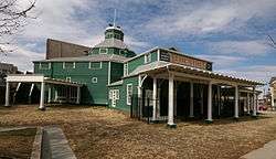
Extends into Union Station in Downtown Denver |
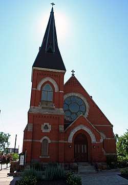
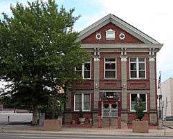
| 2 |
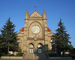
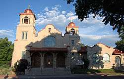
All Saints Episcopal Church |
|
June 23, 1978
(#78000839) |
2222 W. 32nd Ave.
39°45′43″N 105°00′49″W / 39.761944°N 105.013611°W / 39.761944; -105.013611 (All Saints Episcopal Church) |
Highland |
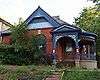
|
| 3 |
Avoca Lodge |
|
January 26, 1990
(#89002373) |
2690 S. Wadsworth Boulevard
39°40′05″N 105°04′50″W / 39.668056°N 105.080556°W / 39.668056; -105.080556 (Avoca Lodge) |
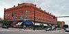
Bear Valley |
|
| 4 |
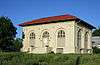
Berkeley Lake Park |
|
September 17, 1986
(#86002255) |
Roughly bounded by the northern side of Berkeley Lake, Tennyson St., W. 46th Ave., and Sheridan Boulevard
39°46′56″N 105°02′52″W / 39.782222°N 105.047778°W / 39.782222; -105.047778 (Berkeley Lake Park) |
Berkeley |
|
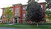
| 5 |
Berkeley School |
|
November 1, 1996
(#96001237) |
5025-5055 Lowell Boulevard
39°47′19″N 105°02′04″W / 39.788611°N 105.034444°W / 39.788611; -105.034444 (Berkeley School) |
Regis |
|
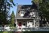
| 6 |
William Norman Bowman House-Yamecila |
|
March 14, 1991
(#91000295) |
325 King St.
39°43′21″N 105°02′01″W / 39.7225°N 105.033611°W / 39.7225; -105.033611 (William Norman Bowman House-Yamecila) |
Barnum |
|
| 7 |
Bryant-Webster Elementary School |
|
December 7, 1995
(#95001421) |
3635 Quivas St.
39°46′03″N 105°00′28″W / 39.7675°N 105.007778°W / 39.7675; -105.007778 (Bryant-Webster Elementary School) |
Highland |
|
| 8 |
Building at 1389 Stuart Street |
|
July 19, 1982
(#82002287) |
1389 Stuart St.
39°44′17″N 105°02′33″W / 39.738056°N 105.0425°W / 39.738056; -105.0425 (Building at 1389 Stuart Street) |
West Colfax |
|
| 9 |
Building at 1390 Stuart Street |
|
July 19, 1982
(#82002288) |
1390 Stuart St.
39°44′17″N 105°02′32″W / 39.738056°N 105.042222°W / 39.738056; -105.042222 (Building at 1390 Stuart Street) |
West Colfax |
|
| 10 |
Building at 1435 Stuart Street |
|
July 19, 1982
(#82002289) |
1435 Stuart St.
39°44′22″N 105°02′33″W / 39.739444°N 105.0425°W / 39.739444; -105.0425 (Building at 1435 Stuart Street) |
West Colfax |
|
| 11 |
Building at 1444 Stuart Street |
|
July 19, 1982
(#82002290) |
1444 Stuart St.
39°44′23″N 105°02′32″W / 39.739722°N 105.042222°W / 39.739722; -105.042222 (Building at 1444 Stuart Street) |
West Colfax |
|
| 12 |
Building at 1471 Stuart Street |
|
July 19, 1982
(#82002291) |
1471 Stuart St.
39°44′23″N 105°02′33″W / 39.739722°N 105.0425°W / 39.739722; -105.0425 (Building at 1471 Stuart Street) |
West Colfax |
|
| 13 |
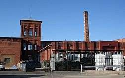
Denver Tramway Powerhouse |
|
September 8, 2001
(#01000940) |
1416 Platte St.
39°45′18″N 105°00′32″W / 39.755°N 105.008889°W / 39.755; -105.008889 (Denver Tramway Powerhouse) |
Highland |
|
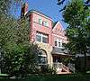
| 14 |
Dickinson Branch Library |
|
March 28, 2002
(#02000262) |
1545 Hooker St.
39°44′29″N 105°01′41″W / 39.741389°N 105.028056°W / 39.741389; -105.028056 (Dickinson Branch Library) |
West Colfax |
|
| 15 |
William J. Dunwoody House |
|
April 11, 1979
(#79000582) |
2637 W. 26th Ave.
39°45′18″N 105°01′11″W / 39.755°N 105.019722°W / 39.755; -105.019722 (William J. Dunwoody House) |
Jefferson Park |
|
| 16 |
Elitch Theatre |
|
March 21, 1978
(#78000844) |
W. 38th Ave. and Tennyson St.
39°46′06″N 105°02′46″W / 39.768333°N 105.046111°W / 39.768333; -105.046111 (Elitch Theatre) |
West Highland |
|
| 17 |
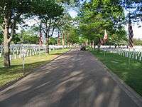
Fort Logan National Cemetery |
|
November 29, 2016
(#16000810) |
3698 S. Sheridan Blvd.
39°38′53″N 105°02′52″W / 39.648126°N 105.047747°W / 39.648126; -105.047747 (Fort Logan National Cemetery) |
|
|
| 18 |
Fourth Church of Christ, Scientist |
|
April 21, 2004
(#04000336) |
3101 W. 31st Ave.
39°45′40″N 105°01′37″W / 39.761111°N 105.026944°W / 39.761111; -105.026944 (Fourth Church of Christ, Scientist) |
West Highland |
|
| 19 |
Hanigan-Canino Terrace |
|
November 25, 1987
(#87001289) |
1421-1435 W. 35th Ave.
39°45′57″N 105°00′12″W / 39.765833°N 105.003333°W / 39.765833; -105.003333 (Hanigan-Canino Terrace) |
Highland |
|
| 20 |
Highland Park |
|
September 17, 1986
(#86002248) |
Roughly bounded by Highland Park Pl., Federal Boulevard, and Fairview Pl.
39°45′47″N 105°01′34″W / 39.763056°N 105.026111°W / 39.763056; -105.026111 (Highland Park) |
West Highland |
|
| 21 |
Highland Park Historic District |
|
January 18, 1985
(#85000082) |
Bounded by Zuni St., Dunkeld Pl., Clay St., and 32nd Ave.
39°45′39″N 105°01′02″W / 39.760833°N 105.017222°W / 39.760833; -105.017222 (Highland Park Historic District) |
Highland |
|
| 22 |
Highlands Masonic Lodge |
|
November 22, 1995
(#95001337) |
3220 Federal Boulevard
39°45′45″N 105°01′27″W / 39.7625°N 105.024167°W / 39.7625; -105.024167 (Highlands Masonic Lodge) |
Highland |
|
| 23 |
Inspiration Point |
|
September 17, 1986
(#86002259) |
Roughly bounded by W. 50th Ave., Sheridan Boulevard, W. 49th Ave., and Fenton St.
39°47′11″N 105°03′22″W / 39.786389°N 105.056111°W / 39.786389; -105.056111 (Inspiration Point) |
Regis |
|
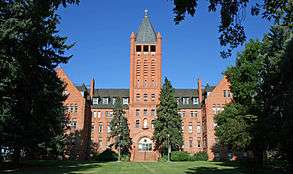
| 24 |
Loretto Heights Academy |
|
September 18, 1975
(#75000510) |
3001 S. Federal Boulevard
39°39′42″N 105°01′38″W / 39.661667°N 105.027222°W / 39.661667; -105.027222 (Loretto Heights Academy) |
Harvey Park South |
|
| 25 |
Frederick W. Neef House |
|
October 25, 1979
(#79000588) |
2143 Grove St.
39°44′59″N 105°01′35″W / 39.749722°N 105.026389°W / 39.749722; -105.026389 (Frederick W. Neef House) |
Sloan Lake |
|
| 26 |
Niblock-Yacovetta Terrace |
|
June 27, 1986
(#86001450) |
1301-1319 W. 35th Ave.
39°45′57″N 105°00′12″W / 39.765833°N 105.003333°W / 39.765833; -105.003333 (Niblock-Yacovetta Terrace) |
Highland |
|
| 27 |
Old Highland Business District |
|
July 17, 1979
(#79000589) |
15th and Boulder Sts.
39°45′29″N 105°00′38″W / 39.758056°N 105.010556°W / 39.758056; -105.010556 (Old Highland Business District) |
Highland |
|
| 28 |
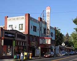
Oriental Theater |
|
September 26, 1997
(#97001167) |
4329-39 W. 44th Ave.
39°46′37″N 105°02′35″W / 39.776944°N 105.043056°W / 39.776944; -105.043056 (Oriental Theater) |
Berkeley |
|
| 29 |
Our Lady of Mount Carmel Church |
|
April 3, 2017
(#100000820) |
3517-3549 Navajo St.
39°45′59″N 105°00′15″W / 39.766442°N 105.004135°W / 39.766442; -105.004135 (Our Lady of Mount Carmel Church) |
|
|
| 29 |
Overland Cotton Mill |
|
April 3, 2001
(#01000288) |
1314 W. Evans Ave.
39°40′36″N 105°00′13″W / 39.676667°N 105.003611°W / 39.676667; -105.003611 (Overland Cotton Mill) |
College View and South Platte |
|
| 30 |
Potter Highlands Historic District |
|
January 22, 1986
(#86000097) |
Roughly bounded by W. 38th Ave., Zuni St., W. 32nd Ave., and Federal Boulevard
39°45′53″N 105°01′09″W / 39.764722°N 105.019167°W / 39.764722; -105.019167 (Potter Highlands Historic District) |
Highland |
|
| 31 |
Rocky Mountain Hotel |
|
April 21, 1983
(#83001314) |
2301 7th St.
39°45′08″N 105°00′51″W / 39.752222°N 105.014167°W / 39.752222; -105.014167 (Rocky Mountain Hotel) |
Jefferson Park |
|
| 32 |
Rocky Mountain Lake Park |
|
September 17, 1986
(#86002250) |
Roughly bounded by Interstate 70, Federal Boulevard, W. 46th Ave., and Lowell Boulevard
39°46′55″N 105°01′47″W / 39.781944°N 105.029722°W / 39.781944; -105.029722 (Rocky Mountain Lake Park) |
Berkeley |
|
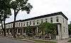
| 33 |
Romeo Block |
|
January 4, 1996
(#95001485) |
2944 Zuni St.
39°45′33″N 105°00′54″W / 39.759167°N 105.015°W / 39.759167; -105.015 (Romeo Block) |
Highland |
|
| 34 |
Amos H. Root Building |
|
March 27, 1980
(#80000894) |
1501-1529 Platte St.
39°45′24″N 105°00′32″W / 39.756667°N 105.008889°W / 39.756667; -105.008889 (Amos H. Root Building) |
Highland |
|
| 35 |
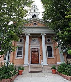
St. Dominic's Church |
|
November 1, 1996
(#96001236) |
3005 W. 29th Ave.
39°45′32″N 105°01′31″W / 39.758889°N 105.025278°W / 39.758889; -105.025278 (St. Dominic's Church) |
West Highland |
|
| 36 |
St. Elizabeth's Retreat Chapel |
|
May 24, 1976
(#76000556) |
2825 W. 32nd Ave.
39°45′46″N 105°01′19″W / 39.762778°N 105.021944°W / 39.762778; -105.021944 (St. Elizabeth's Retreat Chapel) |
Highland |
|
| 37 |
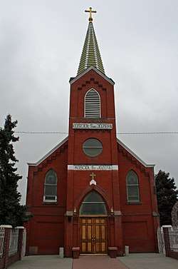
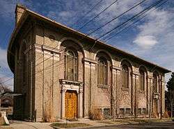
St. Joseph's Polish Roman Catholic Church |
|
April 21, 1983
(#83001315) |
517 E. 46th Ave.
39°46′49″N 104°58′54″W / 39.780278°N 104.981667°W / 39.780278; -104.981667 (St. Joseph's Polish Roman Catholic Church) |
Globeville |
|
| 38 |
St. Patrick Mission Church |
|
November 14, 1979
(#79000593) |
3325 Pecos St.
39°45′49″N 105°00′23″W / 39.763611°N 105.006389°W / 39.763611; -105.006389 (St. Patrick Mission Church) |
Highland |
|
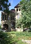
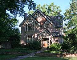
| 39 |
George Schmidt House |
|
October 29, 1976
(#76000554) |
2345 7th St.
39°45′10″N 105°00′52″W / 39.752778°N 105.014444°W / 39.752778; -105.014444 (George Schmidt House) |
Jefferson Park |
|
| 40 |
South Platte River Bridges |
|
October 15, 2002
(#02001128) |
Interstate 25 at milepost 210.53
39°44′36″N 105°00′56″W / 39.743333°N 105.015556°W / 39.743333; -105.015556 (South Platte River Bridges) |
Jefferson Park and Sun Valley |
Extends into Auraria in Northeast Denver |
| 41 |
Stonemen's Row Historic District |
|
January 5, 1984
(#84000824) |
Southern side of 28th Ave. between Umatilla and Vallejo Sts.
39°45′26″N 105°00′43″W / 39.757222°N 105.011944°W / 39.757222; -105.011944 (Stonemen's Row Historic District) |
Highland |
|
| 42 |
Tallmadge and Boyer Block |
|
October 21, 1982
(#82001013) |
2926-2942 Zuni St.
39°45′32″N 105°00′54″W / 39.758889°N 105.015°W / 39.758889; -105.015 (Tallmadge and Boyer Block) |
Highland |
|
| 43 |
Tilden School for Teaching Health |
|
September 7, 1995
(#95001068) |
Junction of W. Fairview Pl. and Grove St.
39°45′51″N 105°01′41″W / 39.764167°N 105.028056°W / 39.764167; -105.028056 (Tilden School for Teaching Health) |
West Highland |
|
| 44 |
West Forty-sixth Avenue Parkway |
|
September 17, 1986
(#86002249) |
W. 46th Ave. Parkway from Stuart St. to Grove St.
39°46′49″N 105°01′33″W / 39.780278°N 105.025833°W / 39.780278; -105.025833 (West Forty-sixth Avenue Parkway) |
Berkeley |
|


_from_northeast_in_2009.jpg)